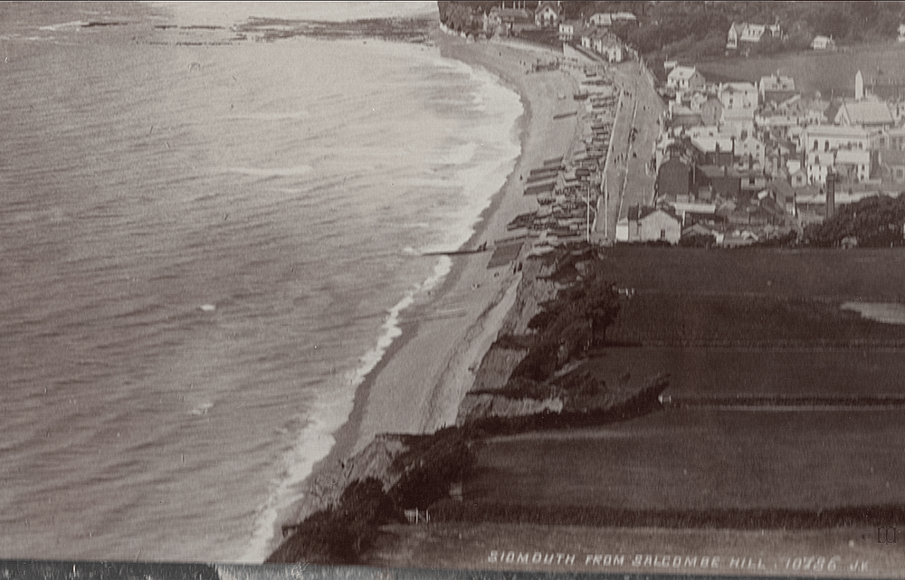
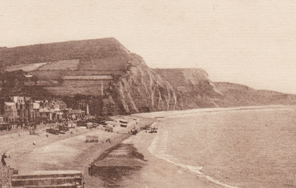
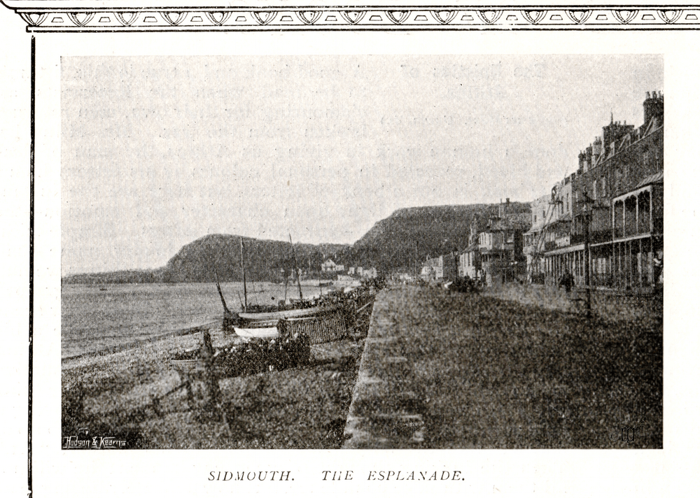
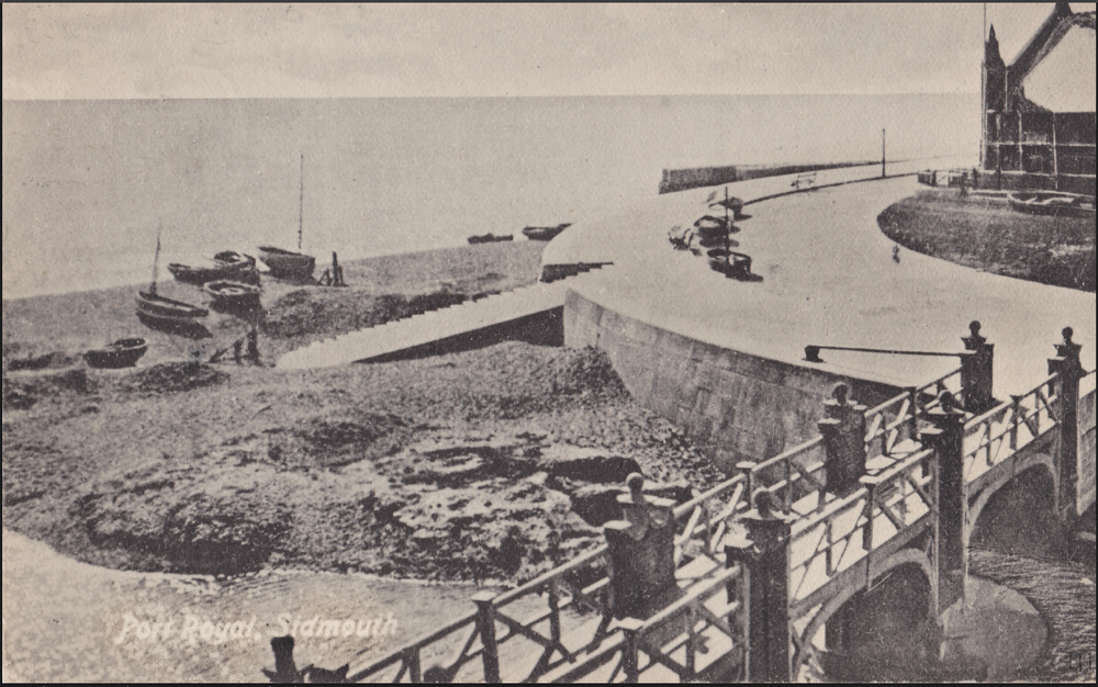
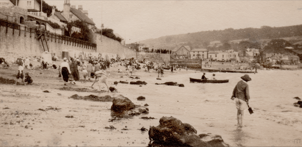
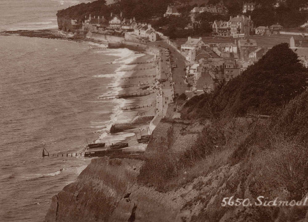
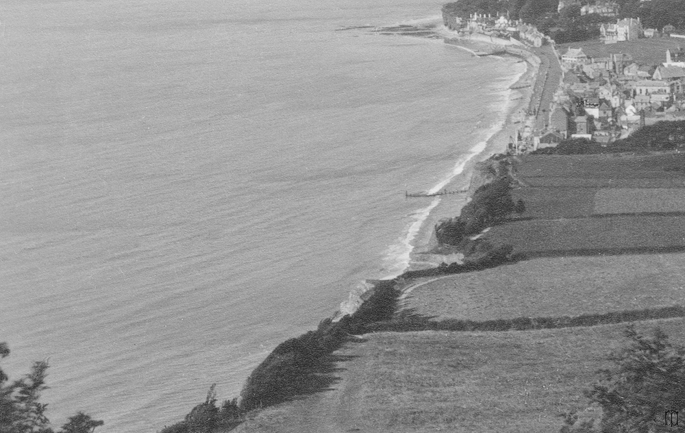
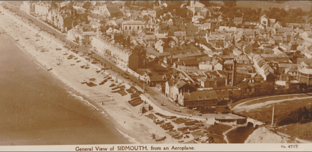
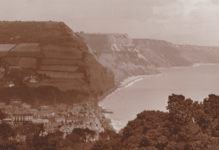
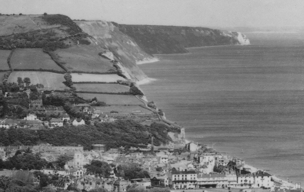
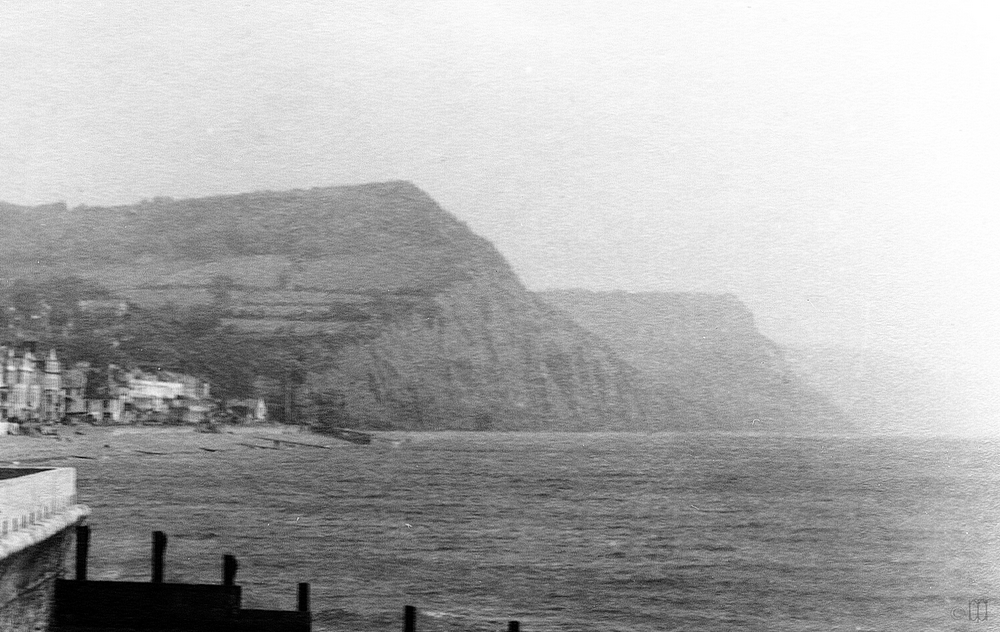
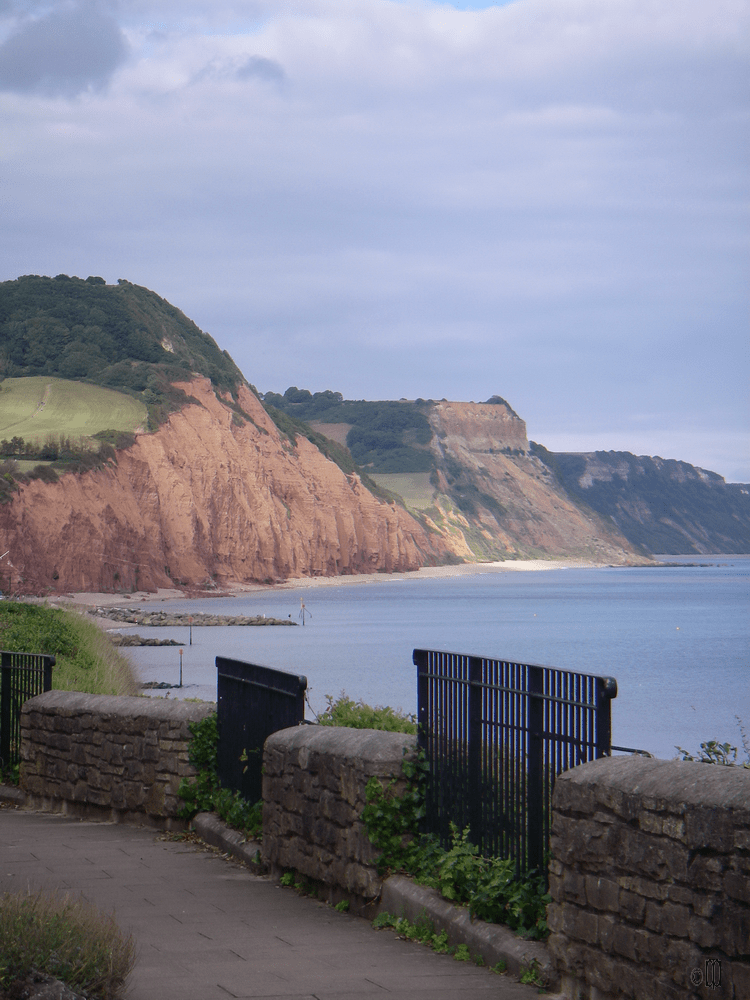
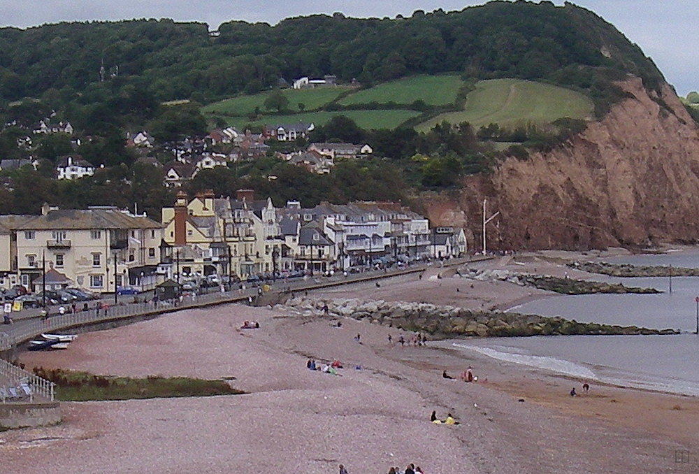
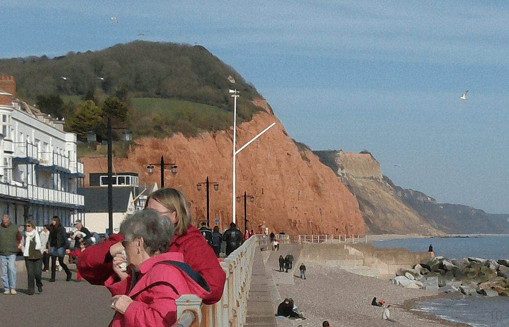
When considering the future it is always helpful to have a view of the things which have happened in the past; we are fortunate that pictures of Sidmouth have been taken since the 1860s and are available to inform us. These images show erosion of the cliffs to the east and how beach levels have varied over time.
The pictures below come from a private collection and are in all cases covered by copyright, please do not reproduce them in any form without written permission. They are details from larger images.
The dates given for the images are as close as can be managed. Some are from private albums or magazines and can be dated accurately, some are known publishing dates for postcards so the image may have been created sometime previously. Some can only be dated by reference to Britain from Above, or records of changes on the front; for example the new design of lamps erected in 1952.
Sea defences
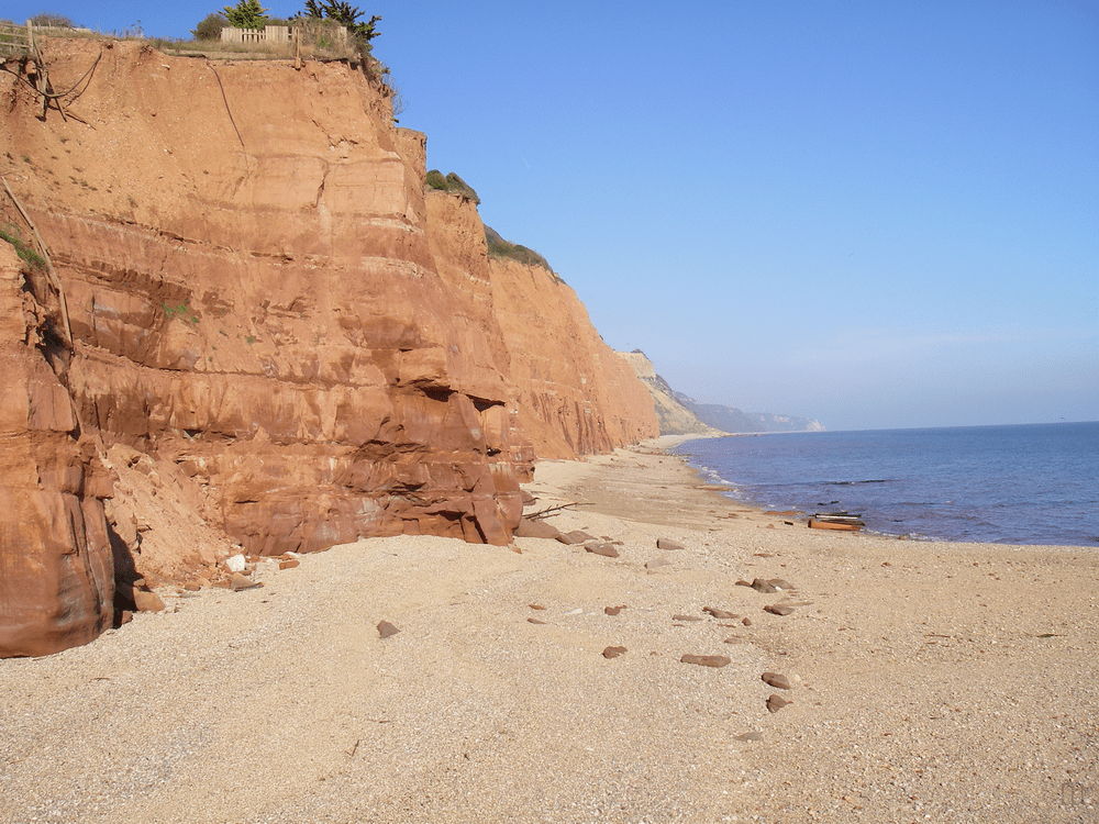
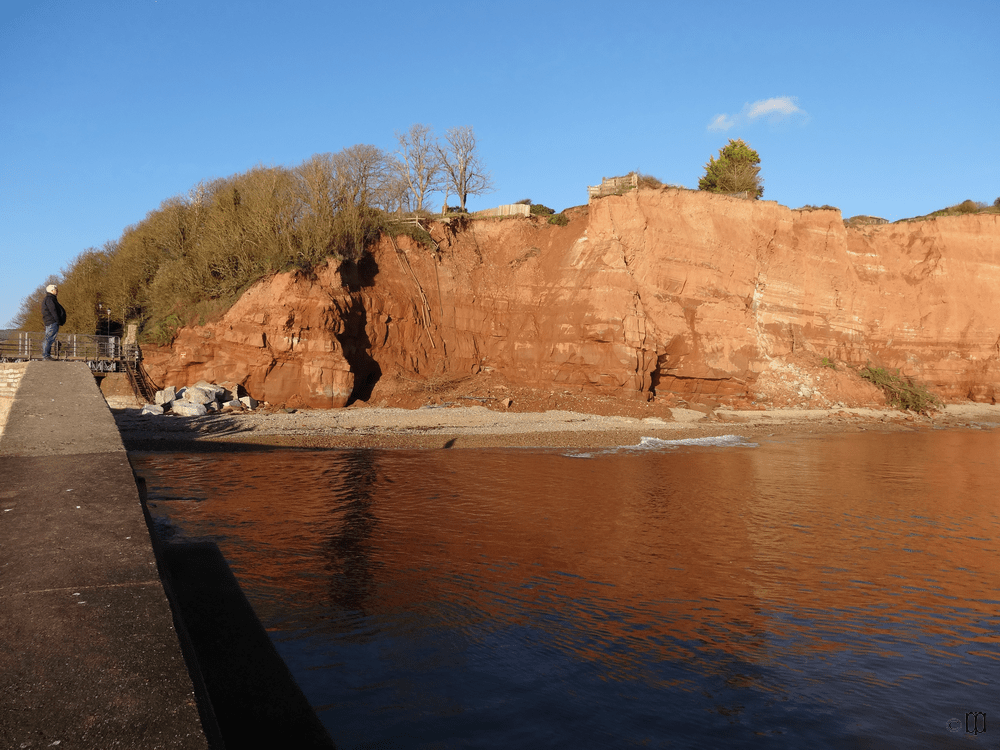
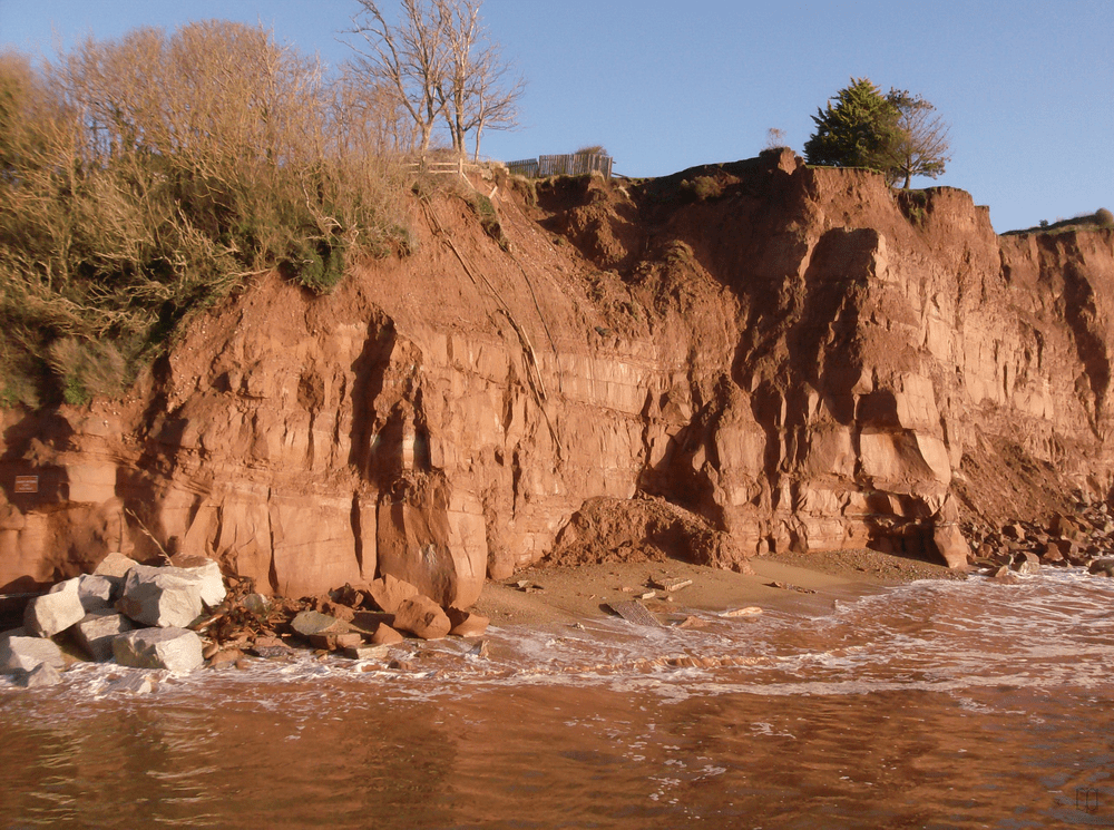
Sidmouth has had to protect itself from the sea since the 1800s; before that the bank of shingle gave good protection by itself but due to a variety of happenings, including the removal of shingle for building purposes and for sale, the shingle bank dwindled and human intervention was needed. This has been an ongoing battle with no real successes except the rock islands built in 1995. These rock islands have allowed a shingle and sand beach to accumulate at Clifton but have not helped elsewhere unless, perhaps, it be at Western, or Jacob’s Ladder, beach. The large amount of shingle at Eastern beach has been lost since the rock islands were put in place but there are differing opinions about whether this is due to the islands or some other change.
This page is intended to give an idea of how cliffs have receded and beach levels have changed.
Newspaper reports available through The British Newspapers Archive permit us to know the ideas put forward in the past including those which were never implemented. Some of them seemed good ideas and others would never have been acceptable to the town which has been reliant on visitors for generations. The Esplanade has often been described as Sidmouth’s shop window and most ideas took this concept into account.
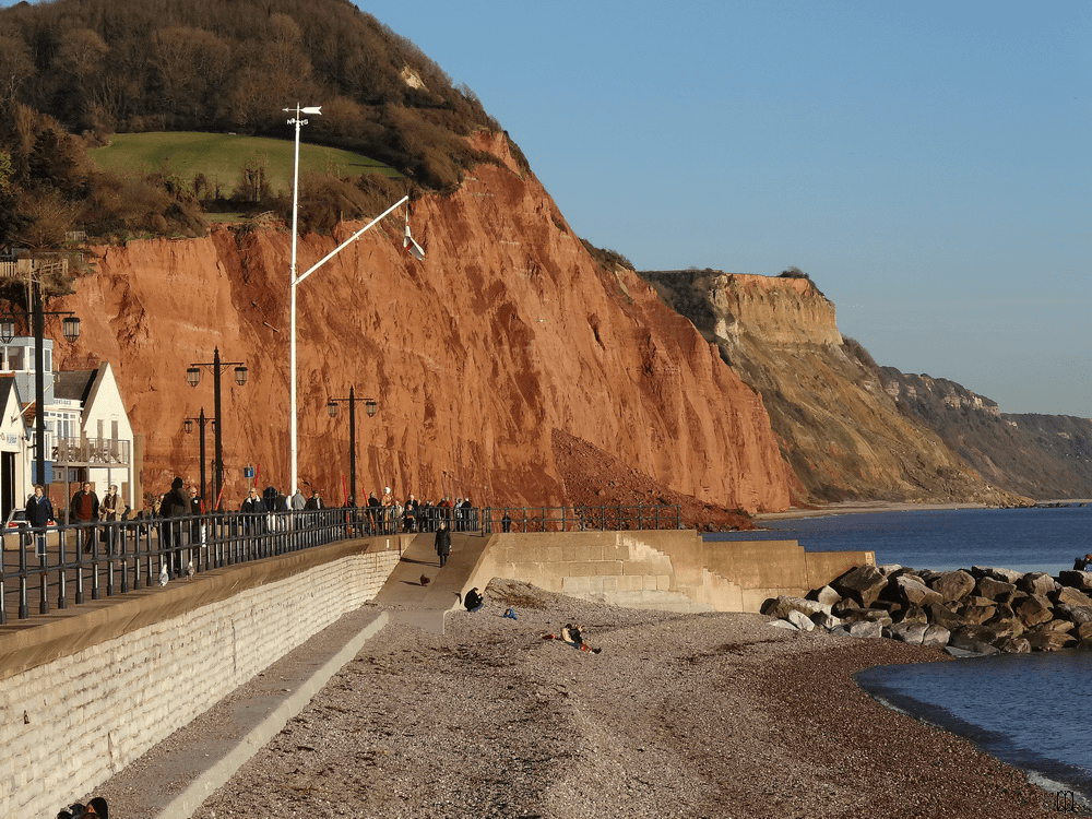
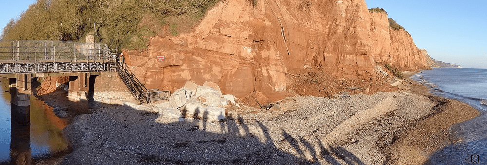
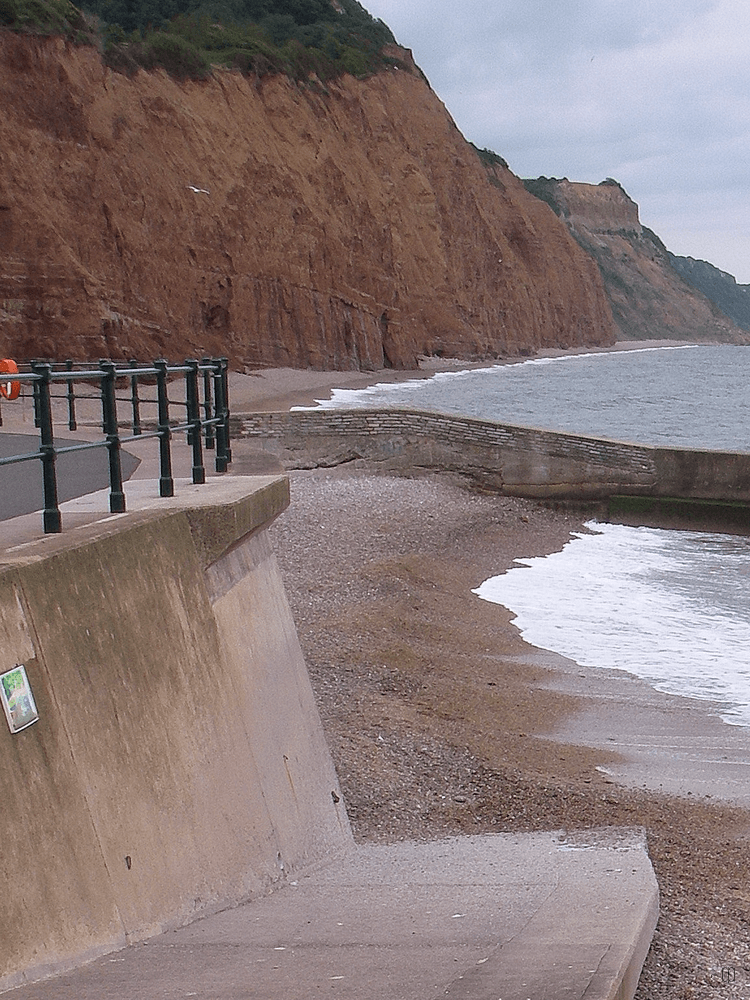
When the beach was being denuded before 1920 the sea wall took some relatively minor damage at the western end, and it was when this was being repaired that the first section of dwarf wall was put in place. This wall was extended over a period of decades until it reached its current length in 1952/3.
In late 1924 there was a major collapse of the seawall at Clifton. After the damage of 1924/5 had been nearly completely repaired, in the Urban District Council meeting of December 1925, as reported in district papers:
Cllr Mr Dagworthy ‘suggested a wall about 2 feet thick and 3 or 4 ft high on the edge of the Esplanade’,
Cllr Mr Hook suggested that Sidmouth follow the example of a Scottish town which had had two or three ships filled with concrete and sunk ‘ a little way out to sea’ which ‘effectively stopped the trouble’.
Cllr Mr Pickerson stated that engineers agreed that a breakwater was needed on Chit Rocks but the town could not afford it.
The suggestions about a breakwater on Chit Rocks and using ships as a defence were discussed at other UDC meetings, as reported in regional newspapers, but Mr Dagworthy’s suggestion seems to have been rejected outright. Such a big wall has proved to be unnecessary in the years since then as there have been no major floods of Sidmouth reported since 1926 when the seawall had been completed. The only major flood was as a result of the Sid breaking its banks.
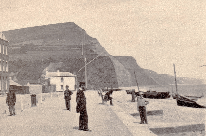
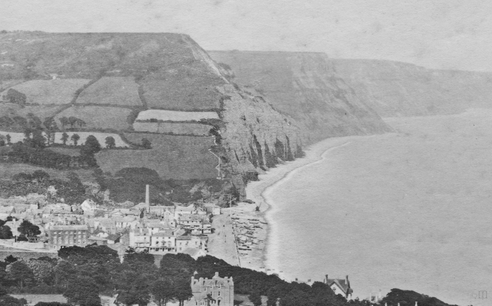
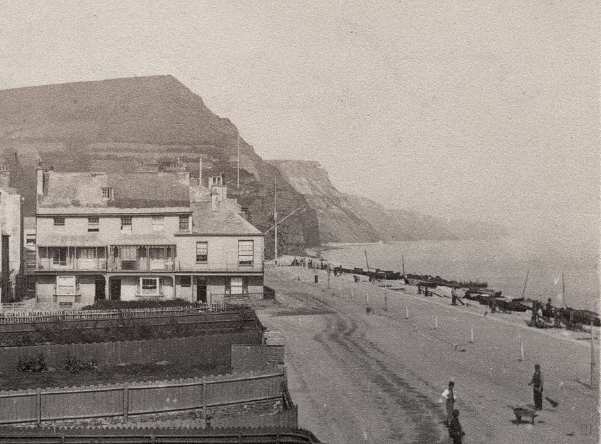
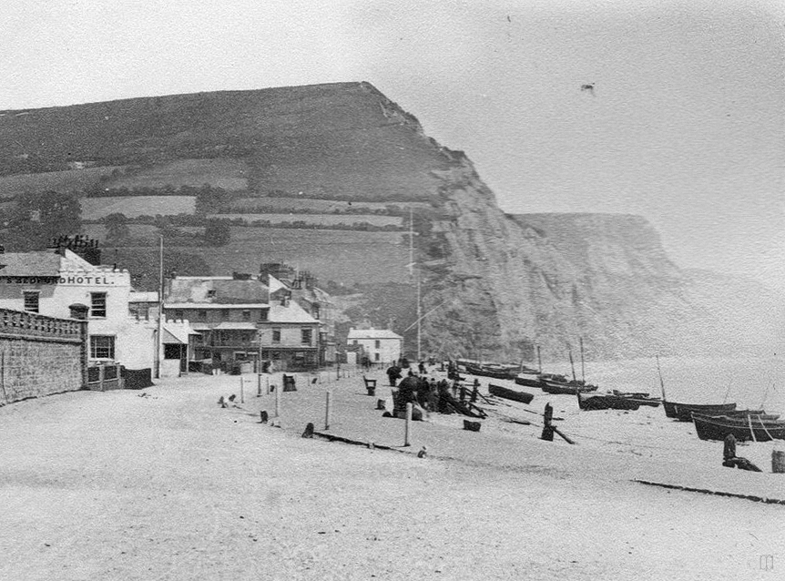
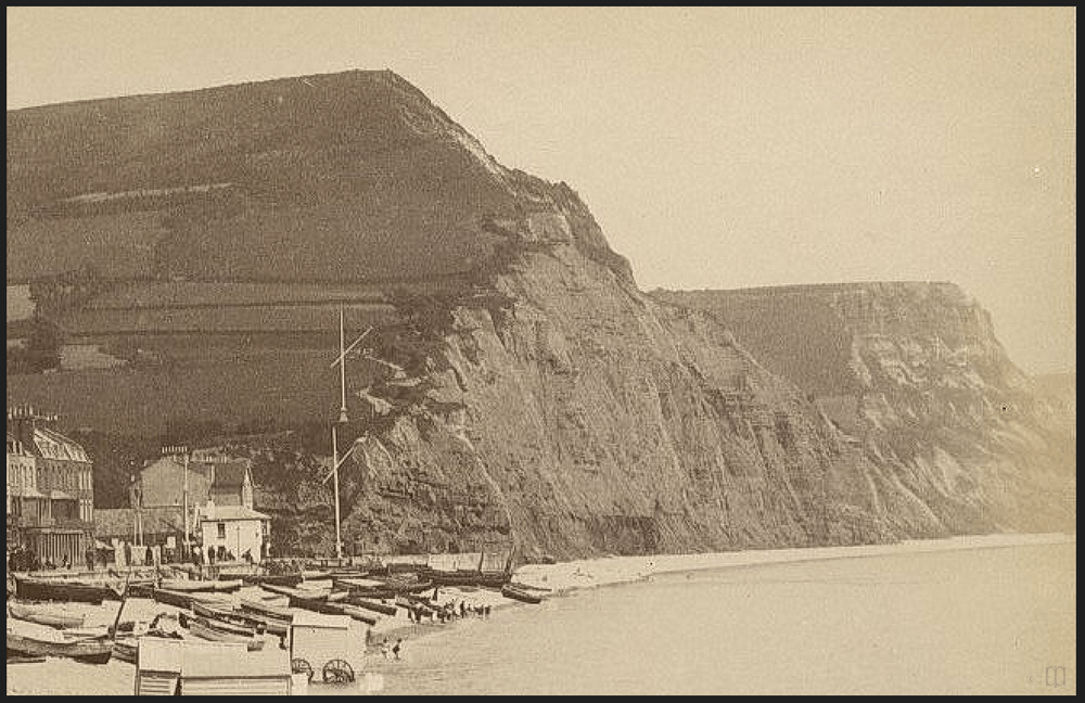
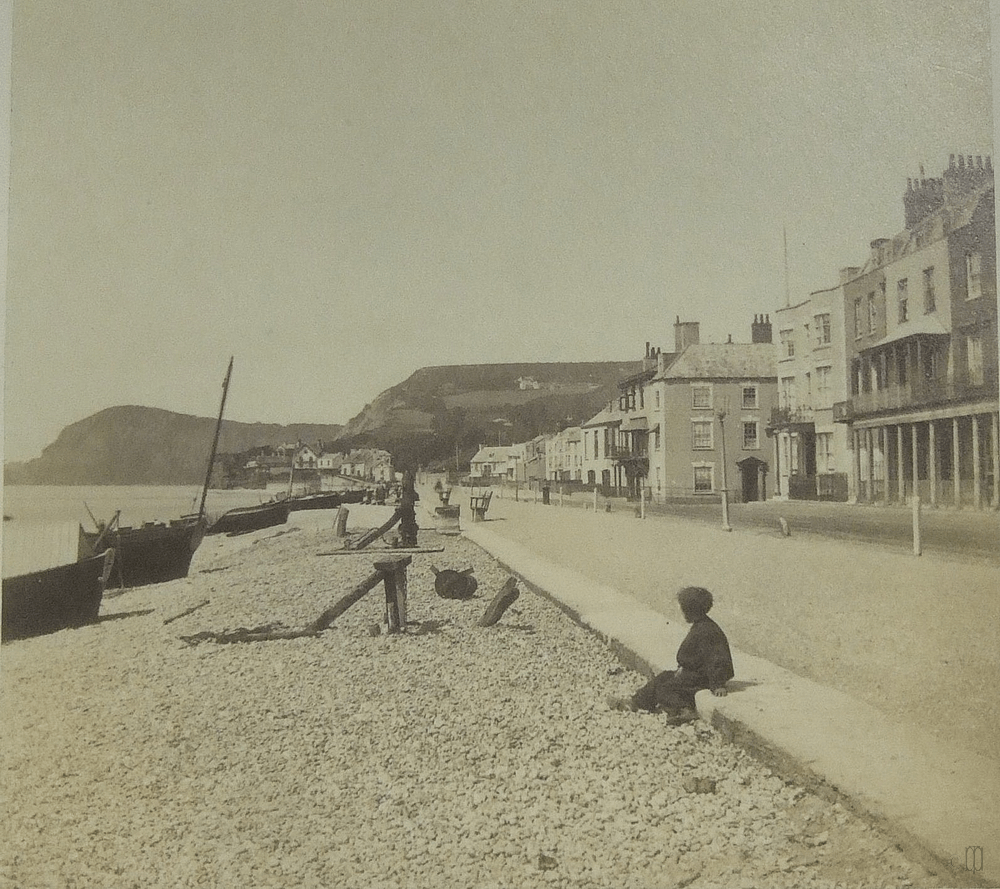
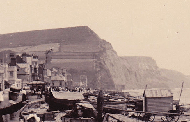
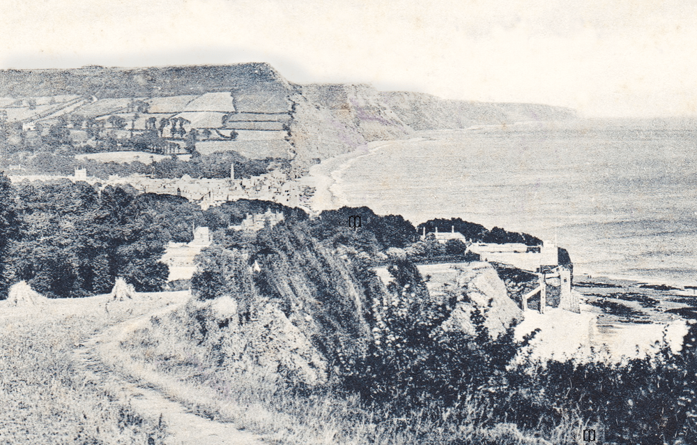
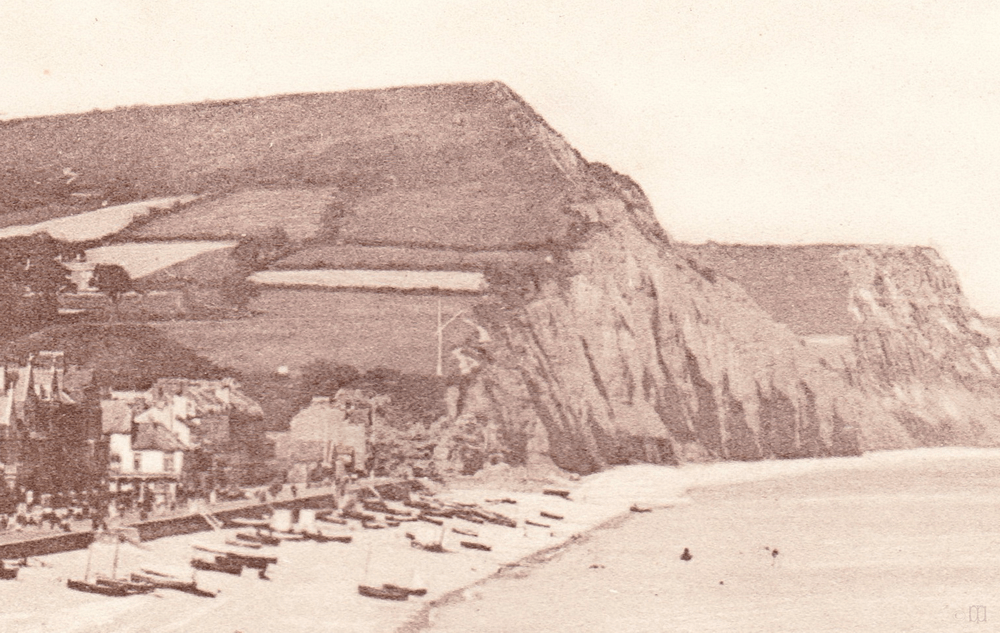
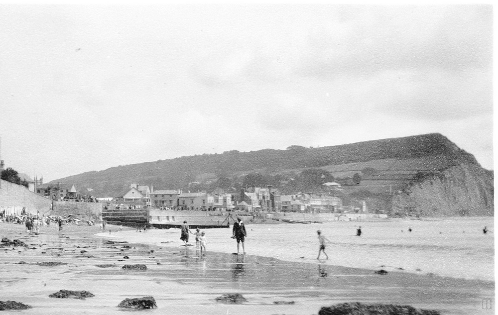
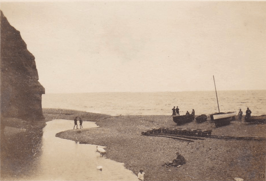
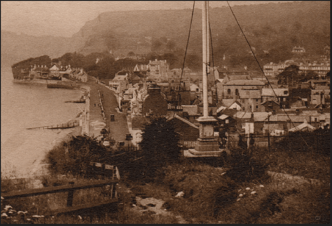
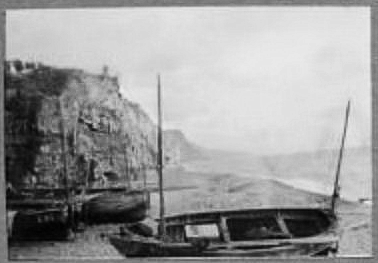
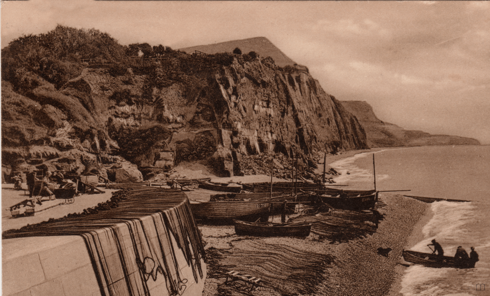
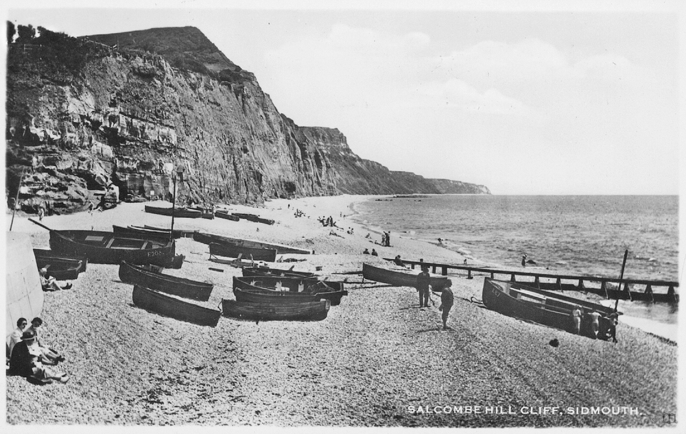
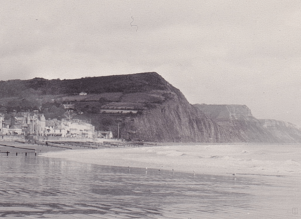
1860s to 1900
The pictures below marked 1860s refers to the printing date. They may have been taken in 1856 when the then Prince of Wales stayed in Sidmouth as they were taken by Francis Bedford who was his official photographer on many of his tours and visits.
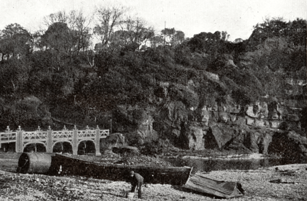
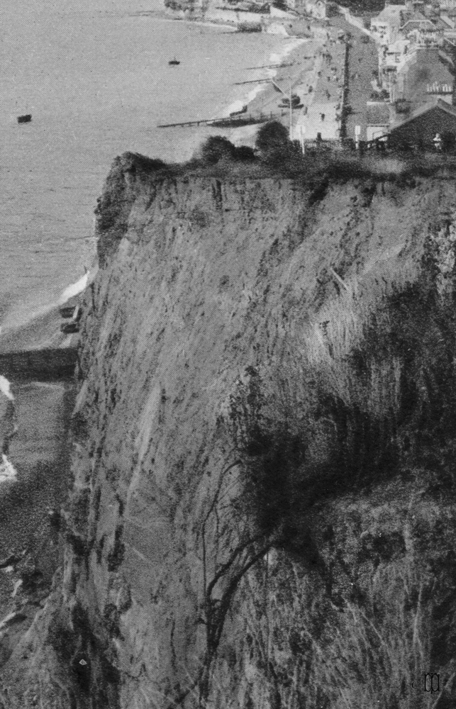
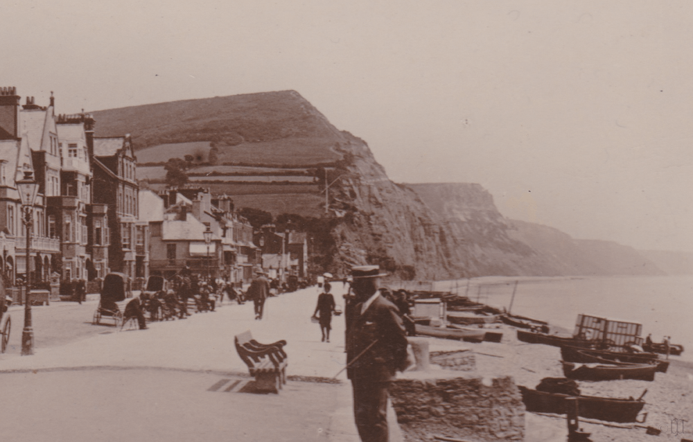
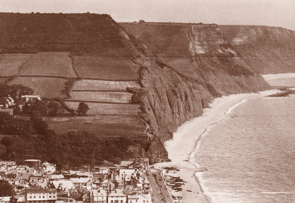
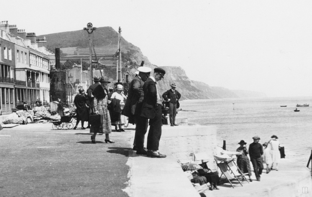
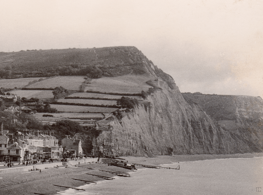
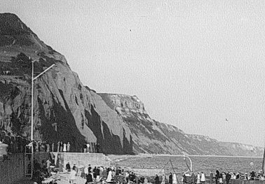
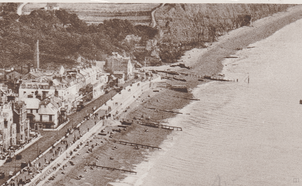
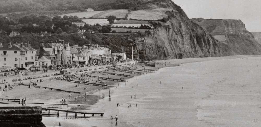
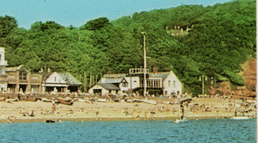
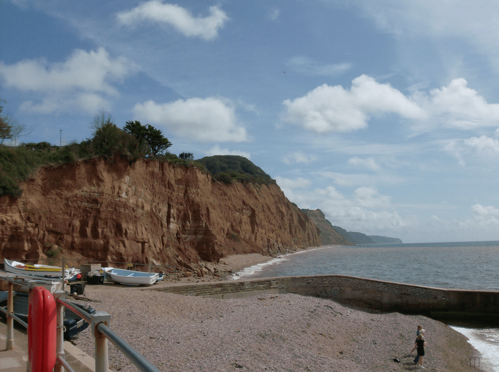
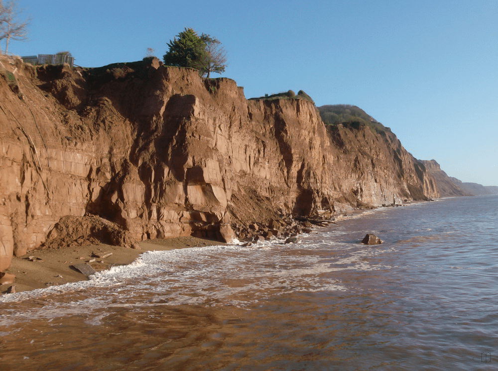
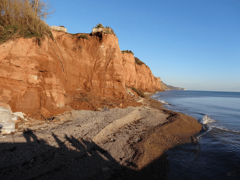
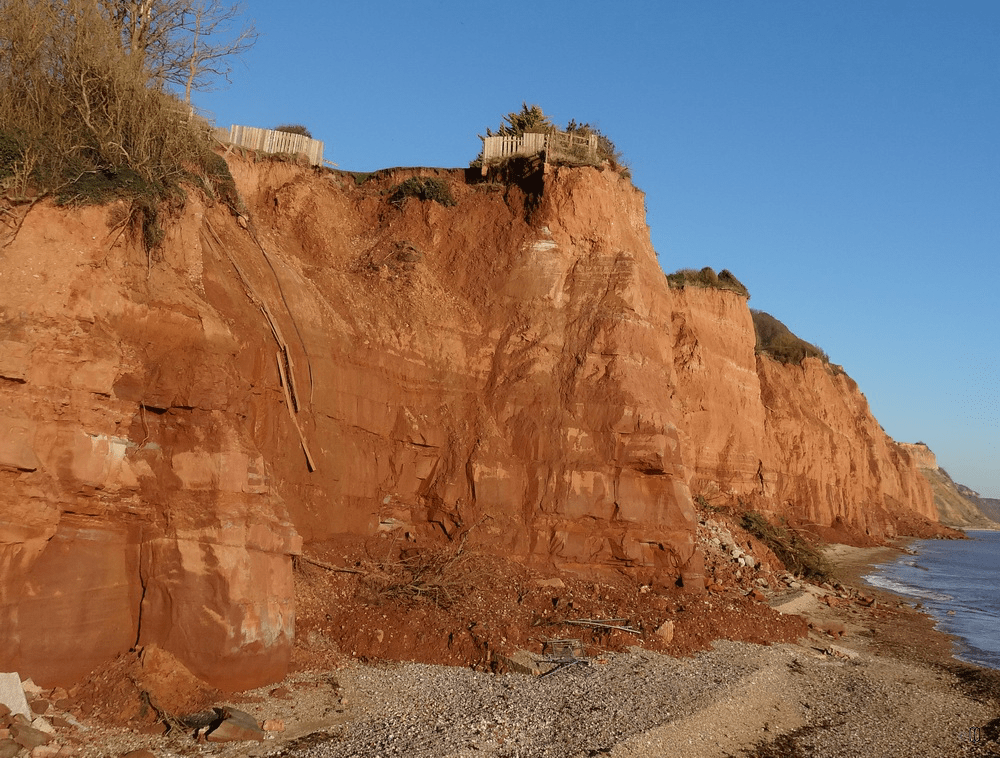
The dark bulk of Pennington Point can be clearly seen on this first picture as the nearest projection of the cliff. Erosion occurred from the top on occasion but did not take place much at the base until around 1920. The flagstaff visible in the picture of the lady was the Jubilee Flagstaff, removed in 1929 as it was in a dangerous position due to cliff falls.


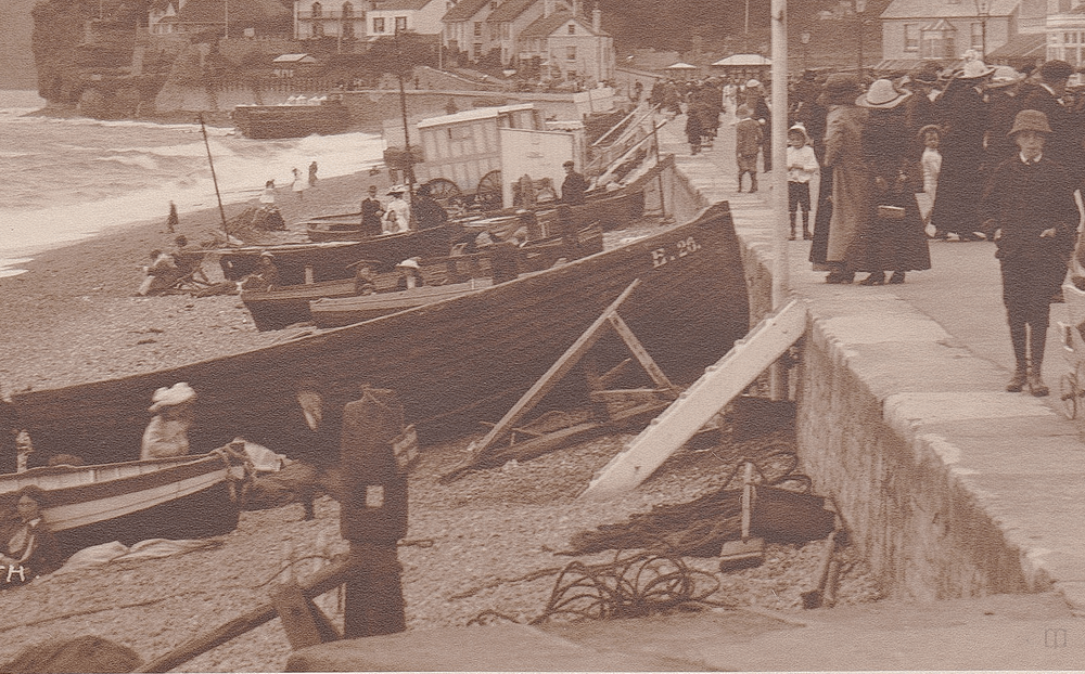
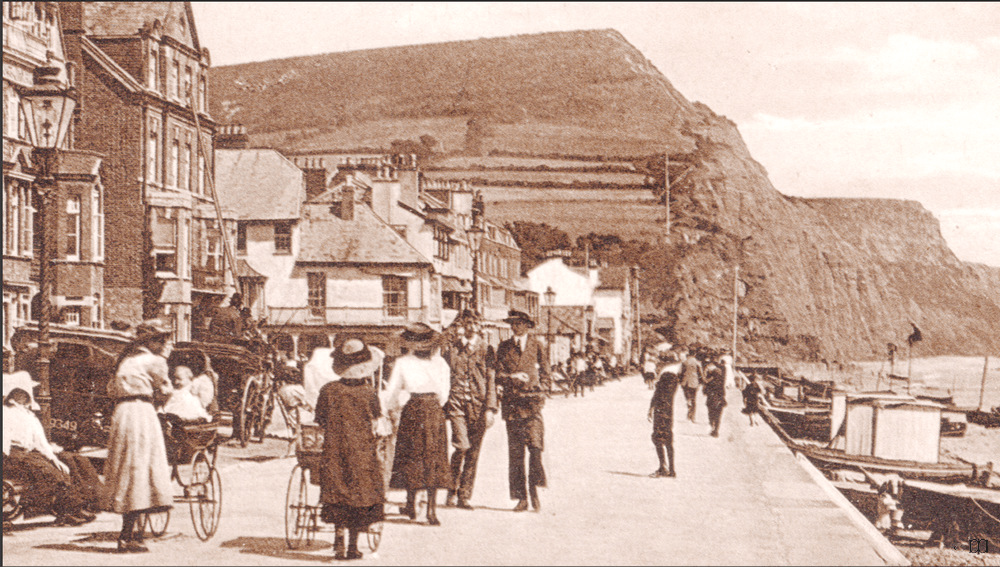
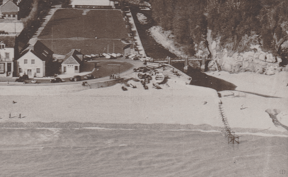
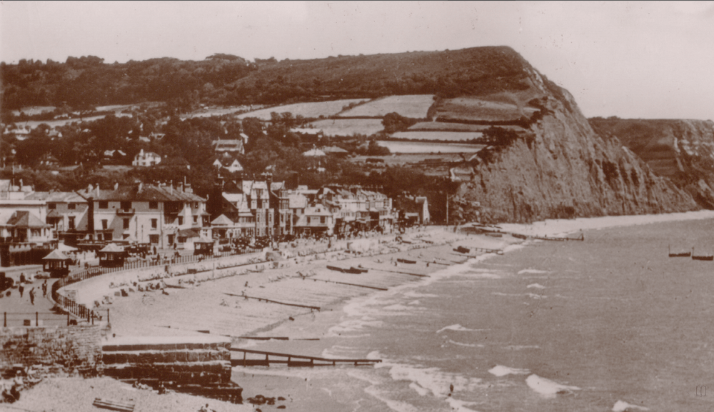
1900 -1910


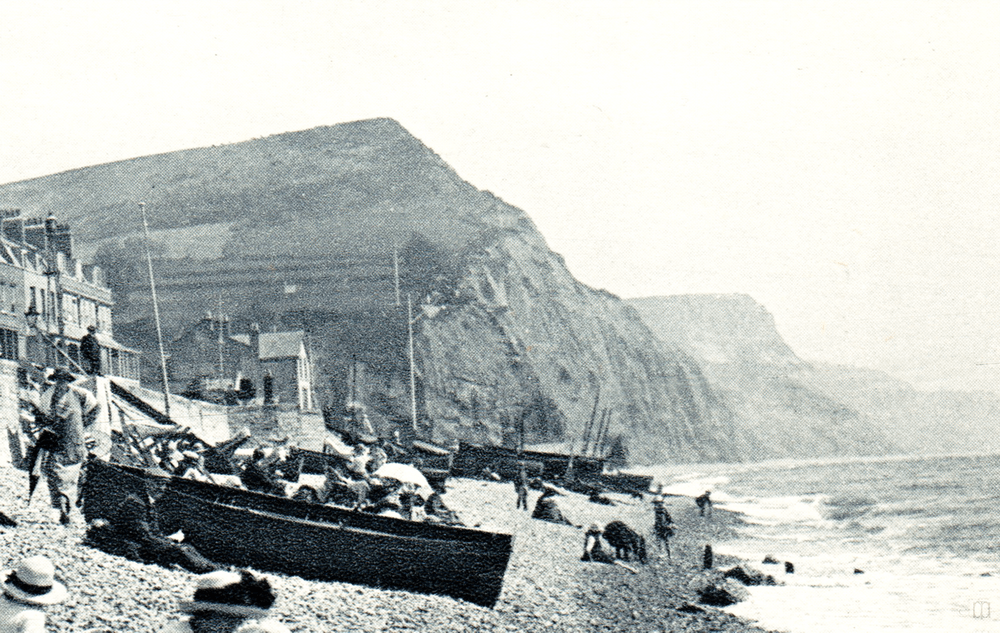
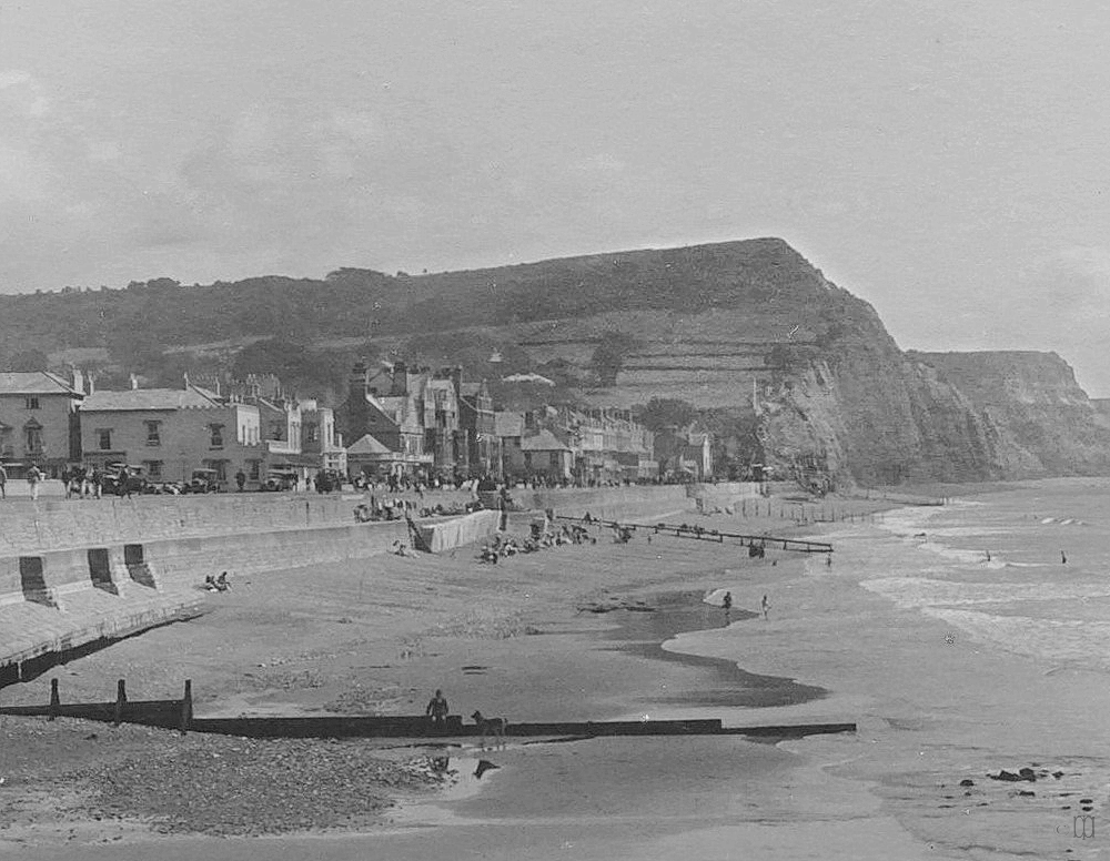
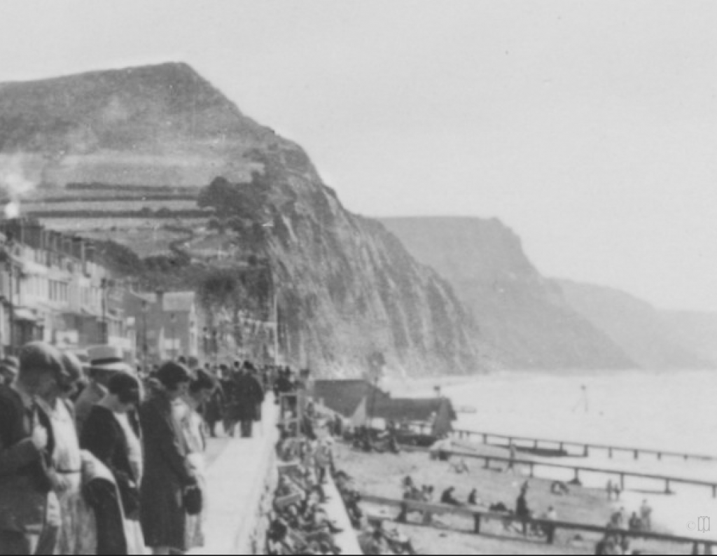
1910 to 1920
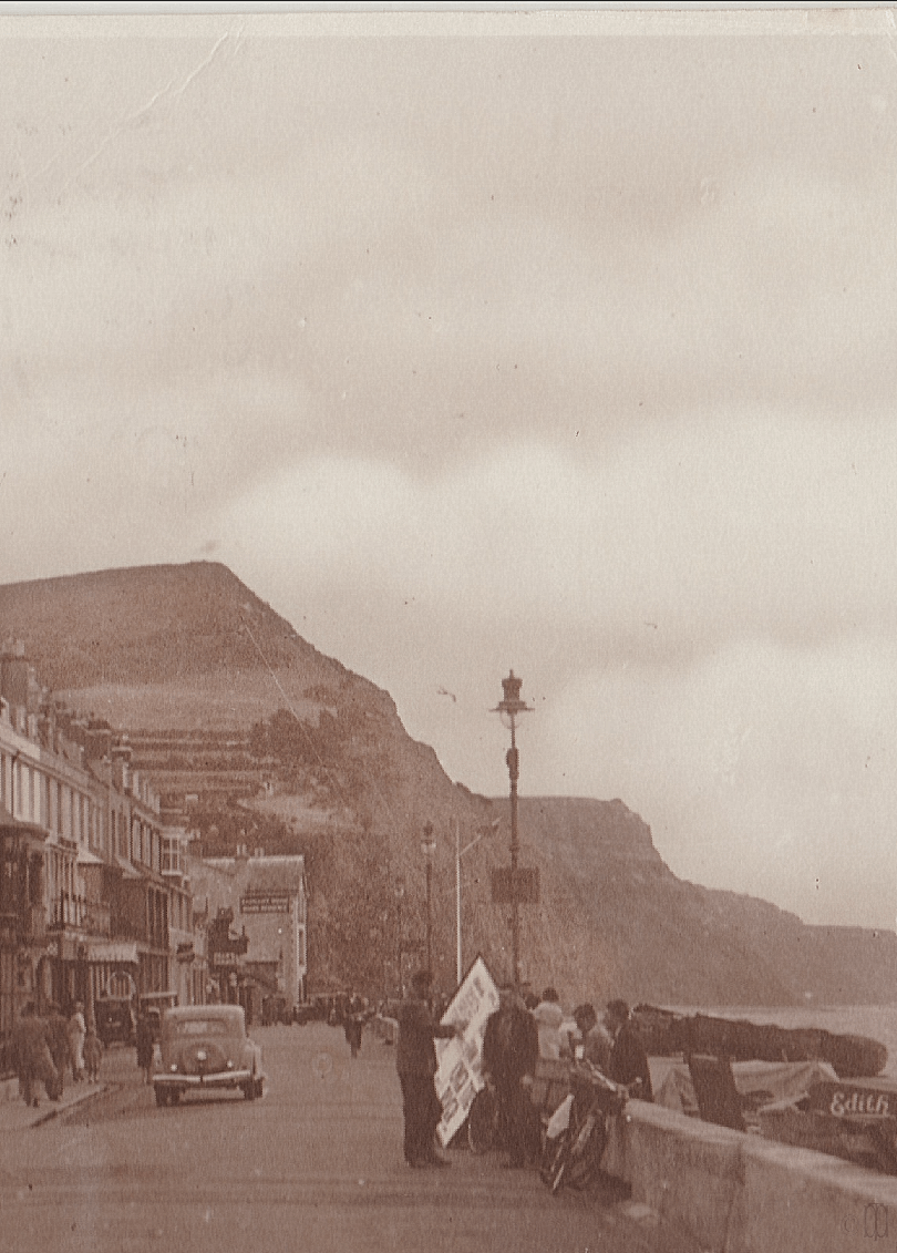
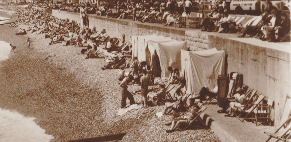
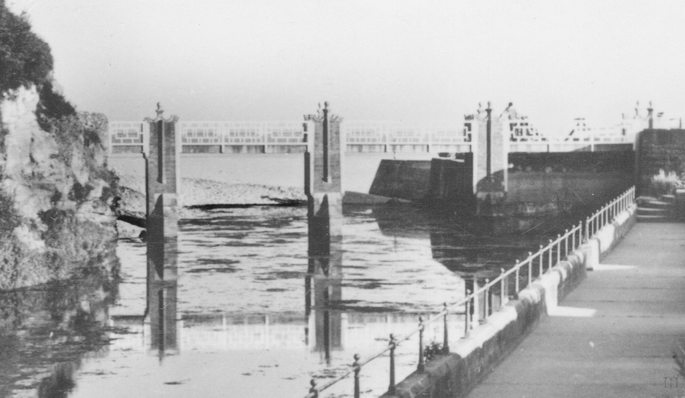
By 1919 the sea wall was taking damage, this was believed to be in part due to the erosion of Chit Rocks. The beach is low.

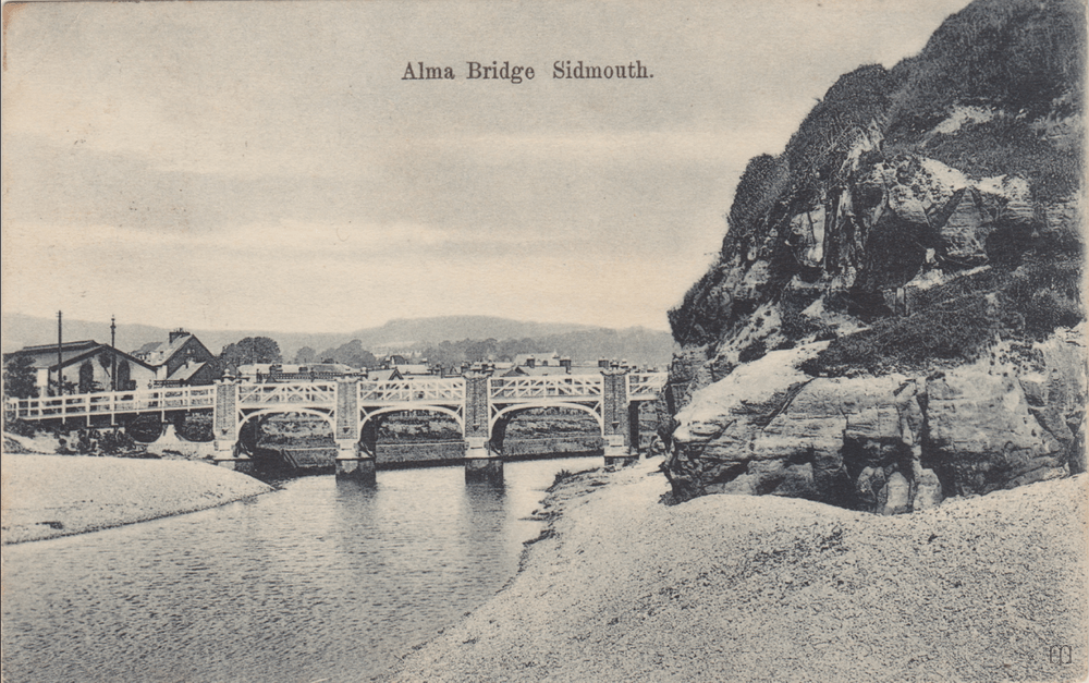
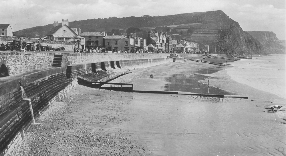
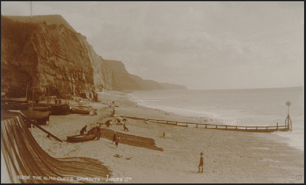
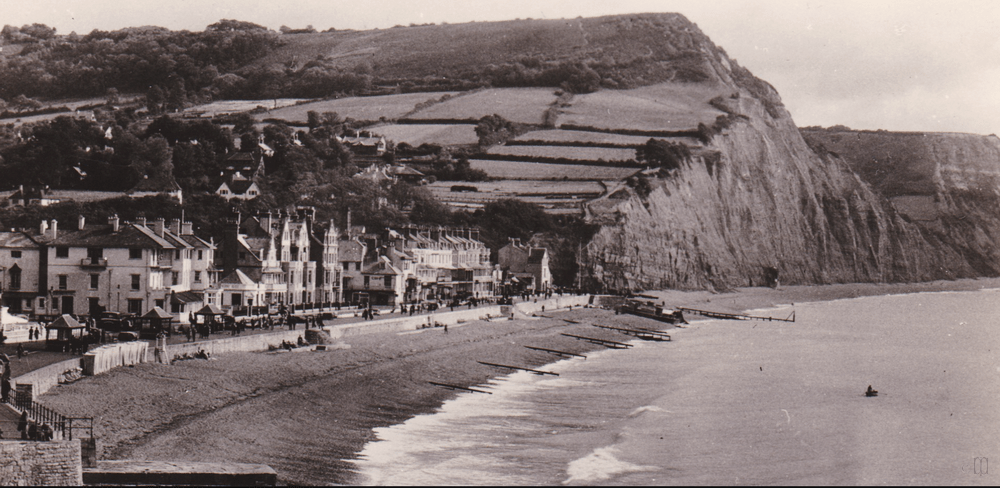
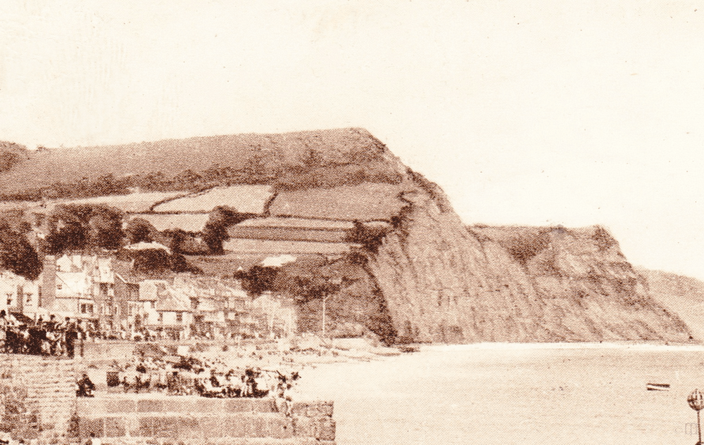
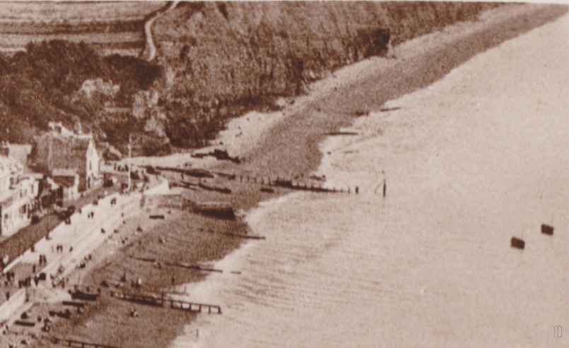
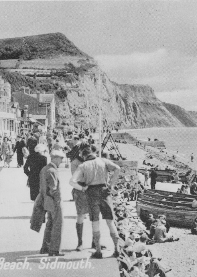
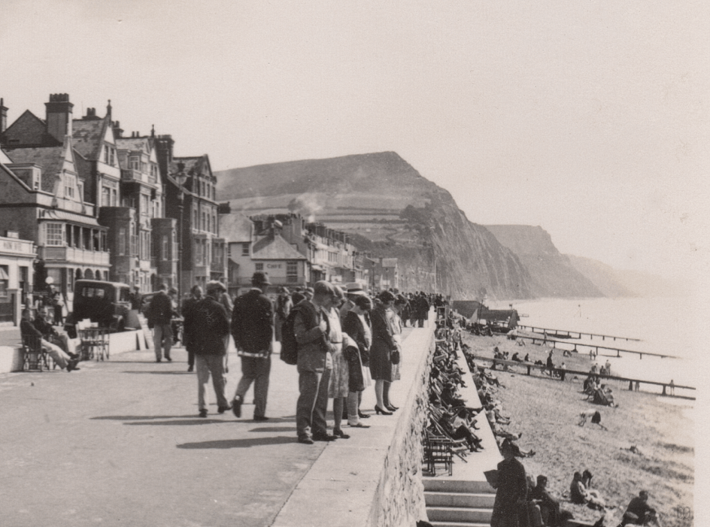
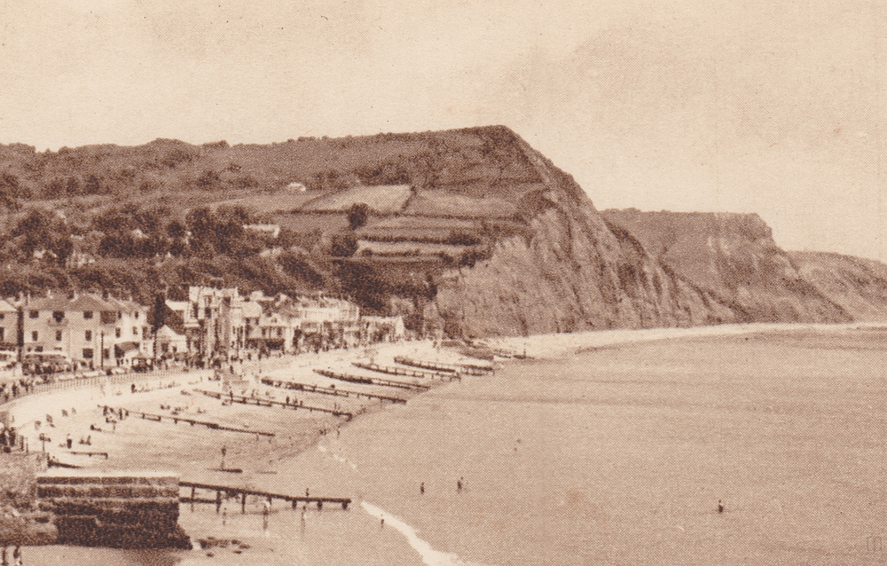
1920 to 1930
The worst damage the seawall took was between the end of 1924 and mid 1925, which required such extensive remedial work that the Esplanade was not reopened until March 1926.
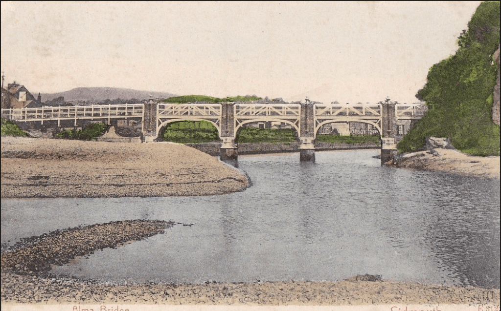
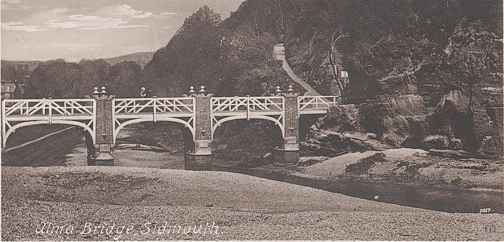
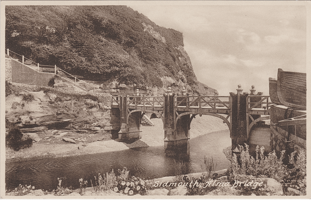
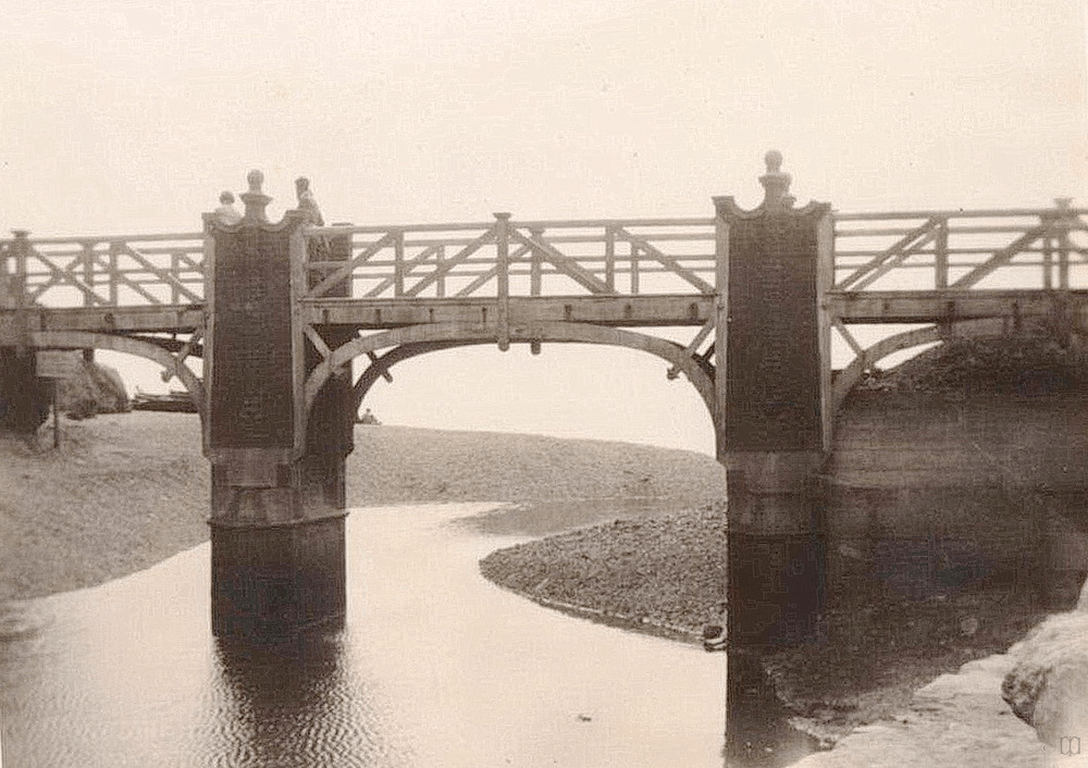
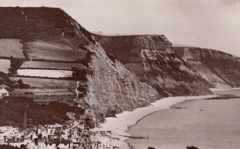
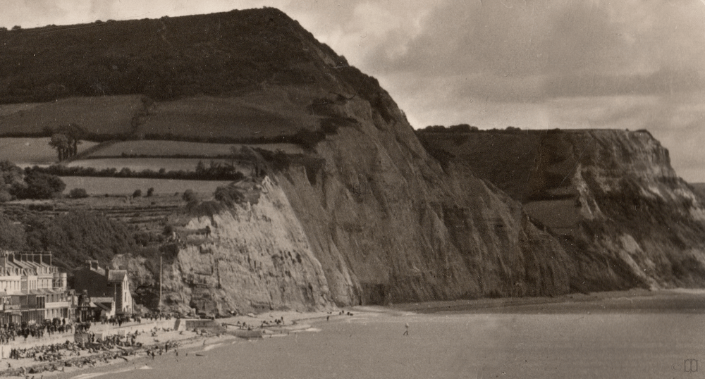
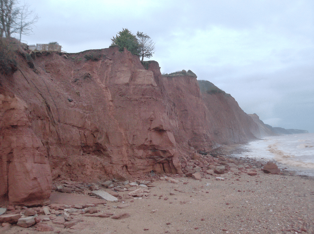
In 1928 a storm removed much of Pennington Point by the Alma Bridge at the mouth of the Sid, and in 1929 the Jubilee Flagstaff was taken down for reasons of safety. From 1930 to 1933 there were many falls at the same place and the loss of rock created a view from the Esplanade all along the cliffs.

.

.

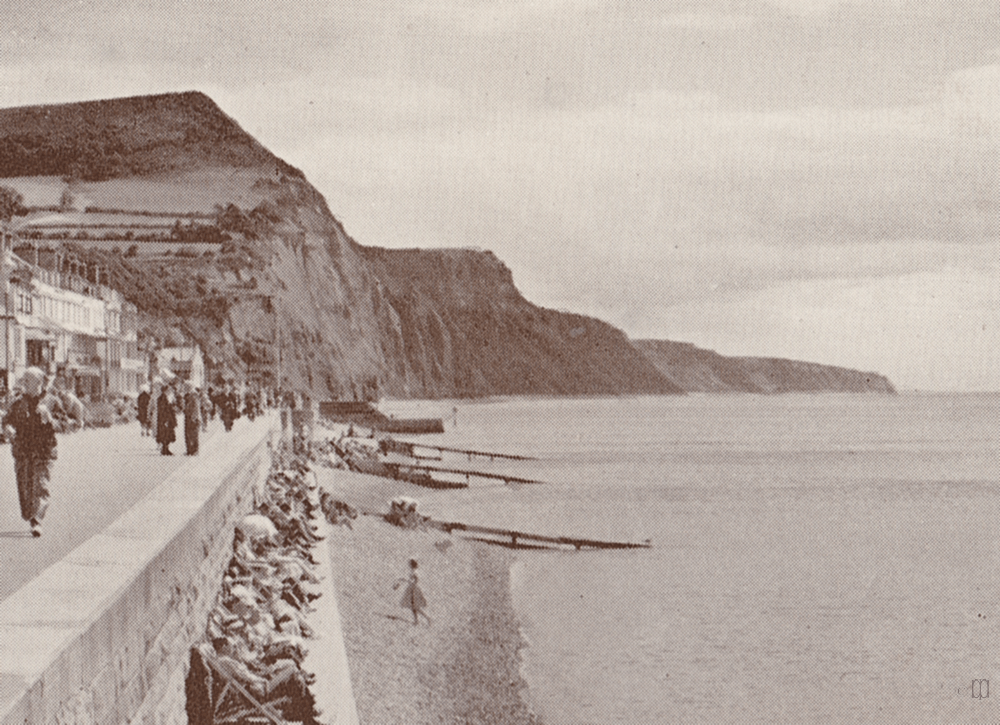
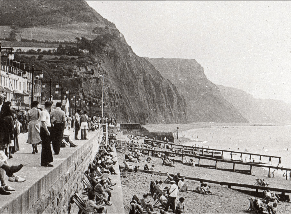
1930 to 1940

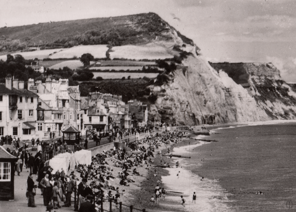
1940 to 1950
Aerial photography came to a halt during the period before and during WWII, and for some time afterwards, as did most building changes; making dating by changes to the Esplanade more difficult from the mid 1930s to 1952, when the new lights were installed on the Esplanade.
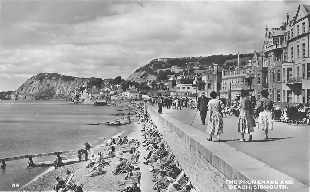
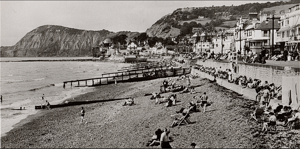
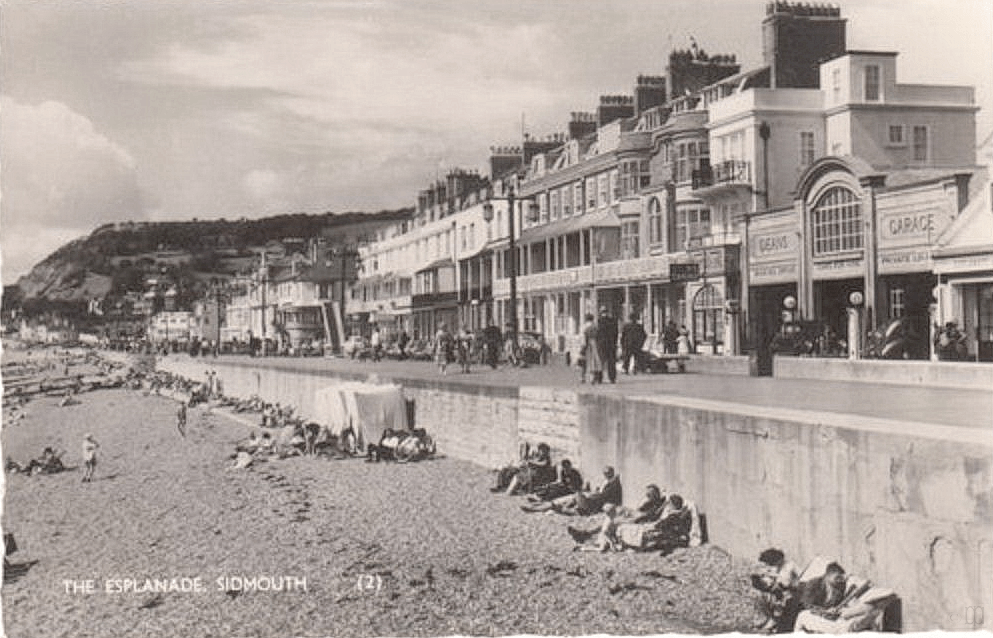
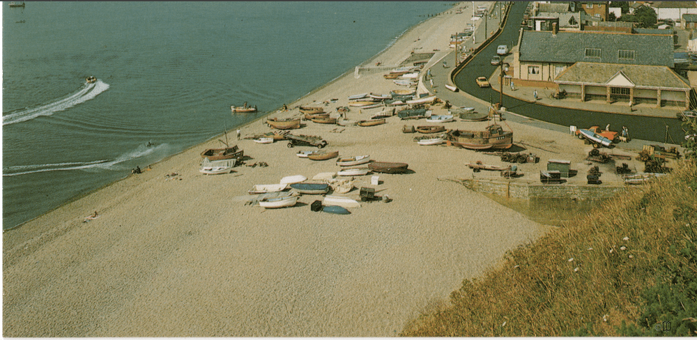
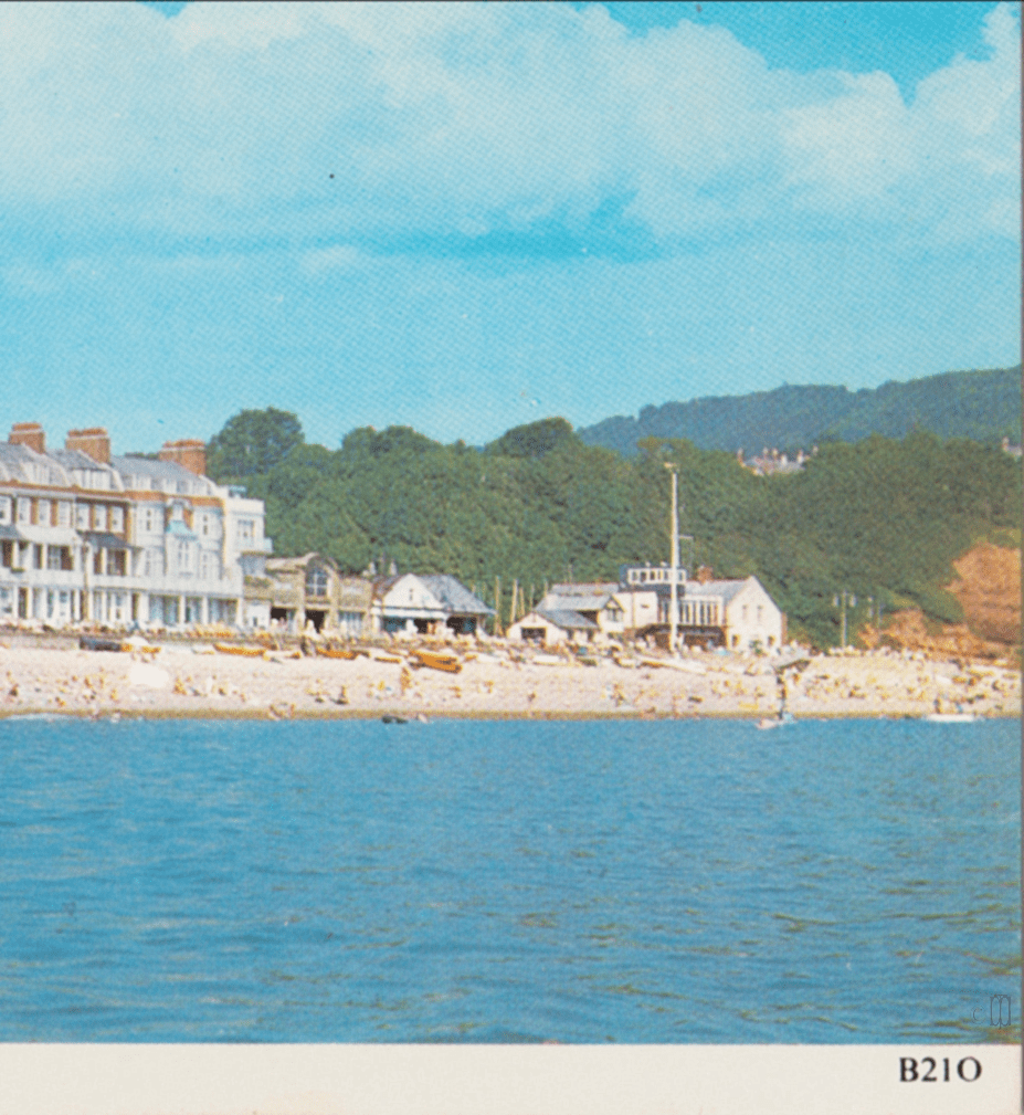
1950 to 1960
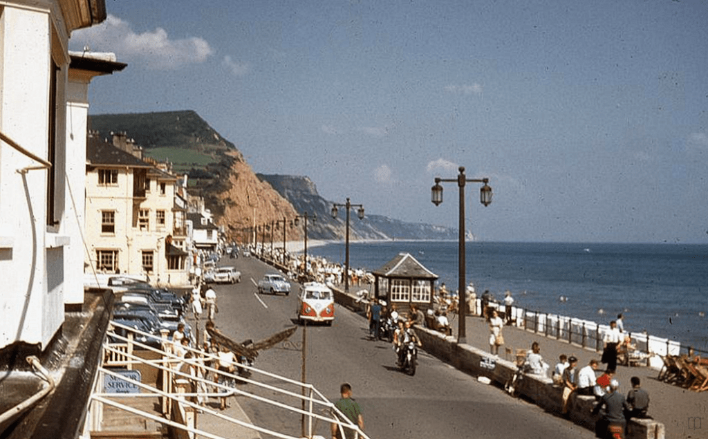
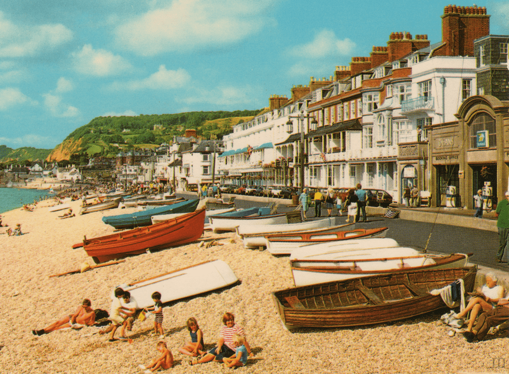
1960 to 1970
As copyright was lengthened for work produced after 1978 they should not usually be shared. Although it can not be proved that the following images were produced before 1978 it seems very likely that they were. If you own the copyright to any image and would like it to be removed please contact us.

After 1970
If you own the copyright of one of the pictures from which these image details have been taken and feel your copyright has been infringed please contact us.
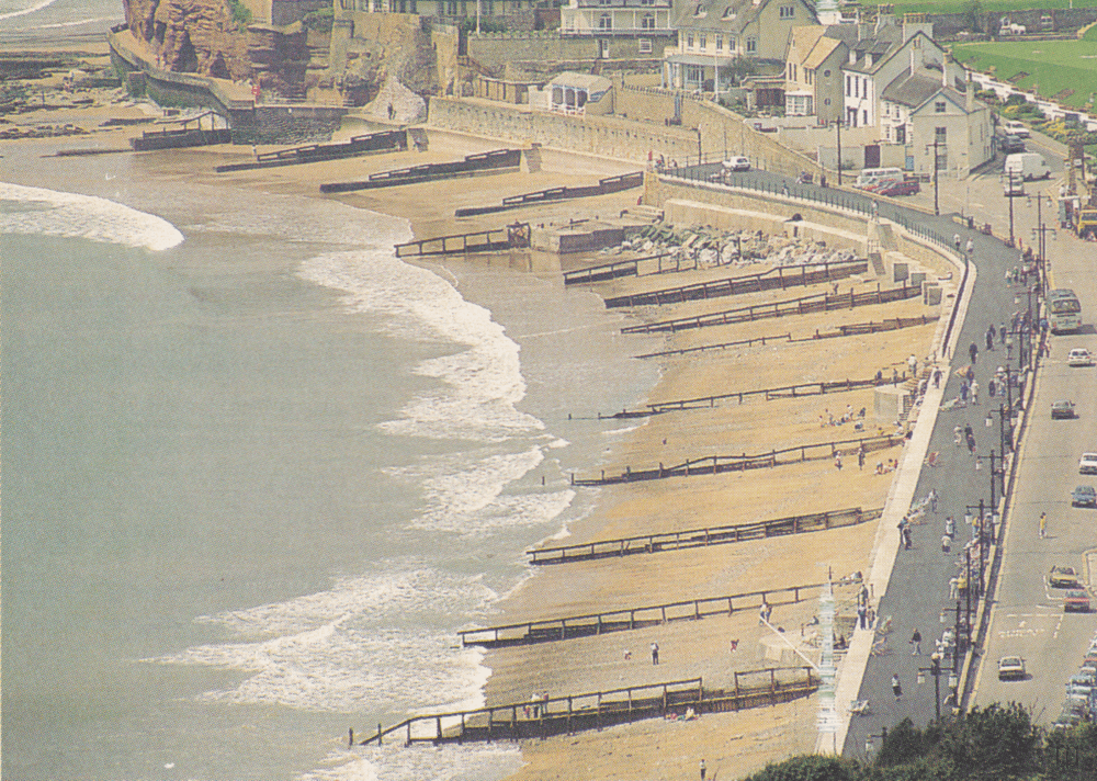

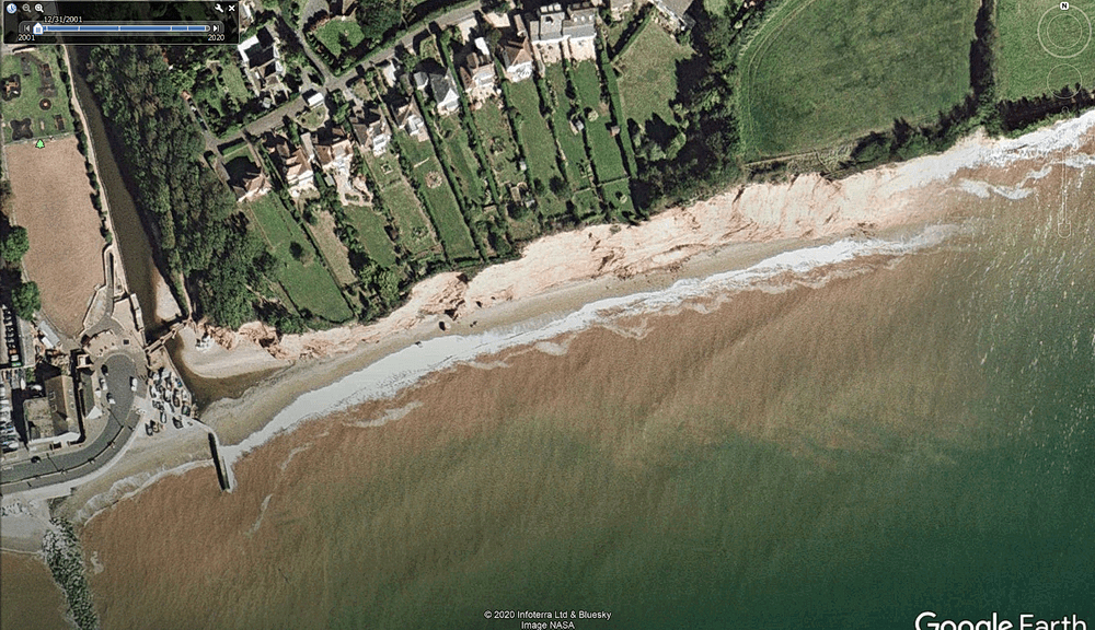
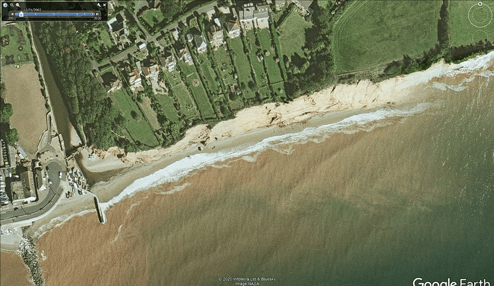
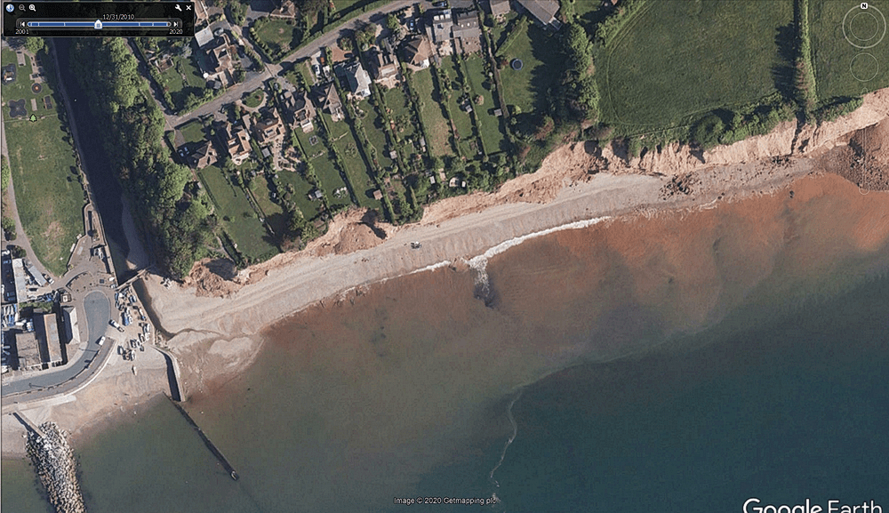
2000 to 2010
We are now reaching the era where technology is providing a store of images, often available online. Google Earth allows you to access 35 years of satellite images, but only a selection are available online for the public, they make all images available to research bodies. It is possible to obtain images from 1985 onwards.
If you have any images we could add here please contact us.


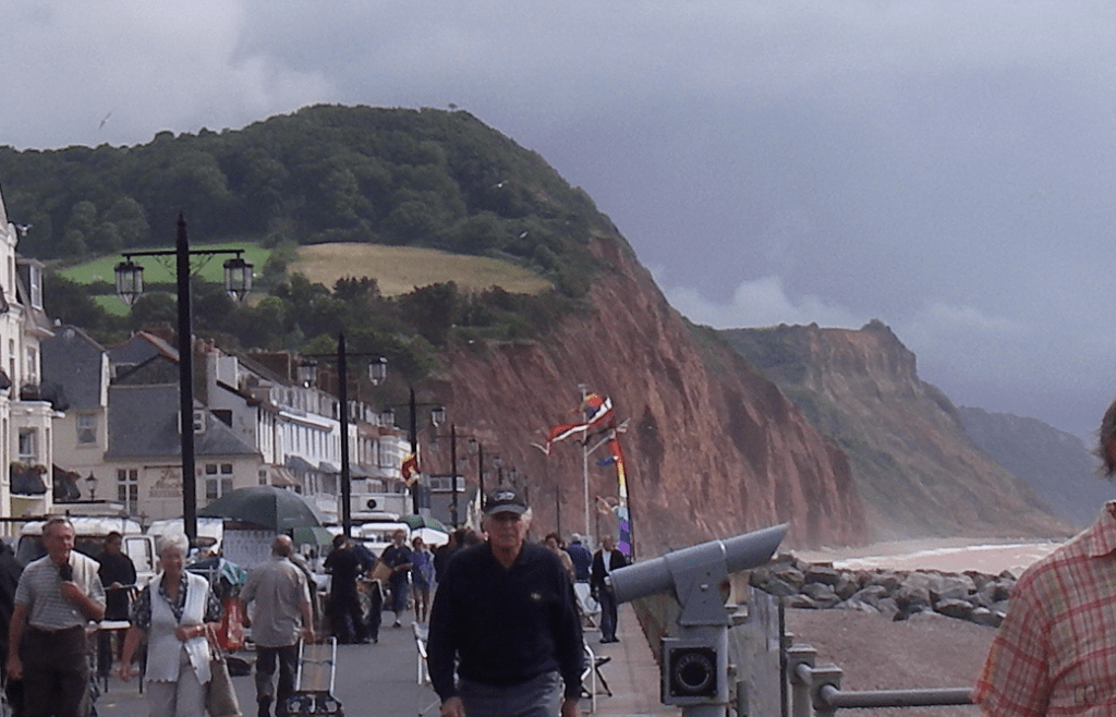

2010 to 2020


Finally, a video from Plymouth Coastal Observatory showing the change at Pennington Point between 2007 and 2015