.
Submitted to the Beach Management Plan steering group’s Sidmouth representatives February 2020:
If you would like to download the pdf you can do so here, otherwise please read on.
.
Reappraising the aims of Sidmouth Beach Management Plan
I appreciate that the BMP has progressed to a BMS and that this document may be seen as unhelpful, or an attempt to set things back years, this is not my intent. The building of additional rock islands is a large undertaking and I am trying to present ideas which might simplify construction of sea defences and reduce costs.
I am not trying to be clever, or thinking I know more than the experts, I hope the ideas can be accepted in the manner in which they are offered.
There are many initiatives being supported by the Government now which were not thought of in January 2017 when the plan was finalised or in 2018 when the public was consulted.
Reframing the question
There is one situation where people are much like computers and that is where outcomes depend on correct input; garbage in = garbage out.
It could be that a question or design brief has been wrongly phrased from the start but it occurs far more often when a question or brief has been mulled over and had bits added for such a long time that the preferred outcome bears little resemblance to what is actually wanted. Much like Chinese whispers where ‘Send reinforcements we’re going to advance’ turned into ‘Send three and fourpence, we’re going to a dance’.
I believe it is now the time for us to restate what we want from the BMP, which is to provide protection against flooding for the town WITHOUT causing a downturn in the Tourist Economy, or the rest of the businesses which rely on that economy.
If we look at what has been done so far in light of this restatement it can easily be seen where the current plans fall short. We have concentrated on the flood and erosion defences and then tried to adapt what we came up with in order to to minimise the effects on tourism. This is not going to work any more than concentrating on tourism would create good defences.
So, if we try to run them in tandem what might we come up with? Perhaps we would find solutions which both provided defence and made the town more attractive to tourists.
That might involve the following:-
1) Barriers that slowed waves and also provided platforms for water sports such as diving.
or
2) Barriers to slow waves and also generate power.
or
3) Barriers to slow waves and also provide a stopping place for a local ferry or sight-seeing trip.
or
4) Barriers to slow waves and also allow the Lifeboat and Sailing Club to get boats in and out of the water.
or
5) Barriers to slow waves and enhance beach access.
or
6) Barriers to slow waves and retain shingle.
or
7) Barriers to protect the seawall.
Or do we need barriers to slow water movement at all? Do we just need to raise heights to take into account rising sea levels?
8) Barriers to make the Esplanade higher
9) Barriers to stop water getting beyond the Esplande walkway.
The list could go on, but for each of them there will be a different optimum solution.
In the following pages I give a few ideas of how we might go forward but I may well be wrong in my ideas as I have no expertise in working with water in any way.
Design ideas
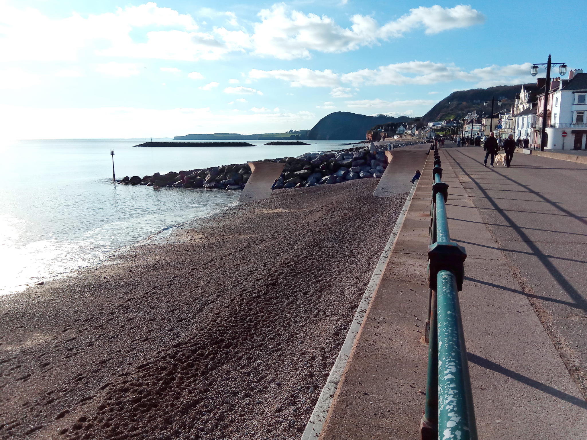
First let’s look at what we have that works along the shoreline.
On Jacob’s Ladder beach and the pathway to it we have concrete platforms and steps which seem to stand up well to the sea.
The concrete platforms have been there in some form for about a hundred years, so there should be a good record about how much maintenance they have required.
Working back towards town we have the walkway itself and a set of steps going down towards Chit rocks. The steps are protected on each side by armouring. So our second question is how well do these two things survive with armouring defending them? In the last decade I have not noticed much need for repair.
At the other end of the walkway we have another set of steps, partially protected by armouring but in the early part of the decade also protected by shingle. These steps also seem to take little damage even now when the shingle has gone.
If things at this end of the beach survive despite being open to southwesterly storms then can we use similar constructs on the Town beach?
Judging by the state of the concrete ramps and steps in town the answer would seem to be yes.
If we can use this knowledge of how things survive in the conditions of Sidmouth then do we need the proposed off shore islands?
If we don’t need the islands than could we redeploy that rock to better purpose?
Some of the initial ideas for the BMP had the rock groynes on land in a variety of configurations so it would seem that the islands are not necessary.
If we take a step back and look at what Sidmouth could benefit from we get the following list, which is not exhaustive.
• Sandy beach
• Safe bathing
• Safe water activities
• Ease of getting to the water at various times of the tide
• Places to sit flat or put chairs
• Ability to get pushchairs etc on to the beach
• Access to the sea for those with limited mobility
• Places to lie flat and sunbathe
• Places for families to play games
• Interesting things for children to explore where they can develop muscles and balance
• Way of dealing with the shingle ridges which form and make the beach difficult to navigate
• Sheltered places to sit when it is windy or drizzling
• Somewhere high for a lifeguard to sit, with easy access. (Relevant to the current work towards Sidmouth gaining Blue Flag status)
• Safe access to the water for the sailing boats, Lifeboat, and other sea craft. (Relevant to the Government’s interest in increasing waterborne transport.)
It would seem to me that it would be possible to use the blocks currently intended for the new rock islands to achieve most of this wish list. However, I do not know about water dynamics and it may be I am wrong.
Importantly amalgamating several different initiatives into the BMP would give access to funding from different bodies and so make it more affordable.
How might this be achieved?
Using the knowledge of what works on Sidmouth’s beach I think we should look at making more ramps for beach access. If the current groynes were used as a base to support concrete ramps it could make the beach more accessible.
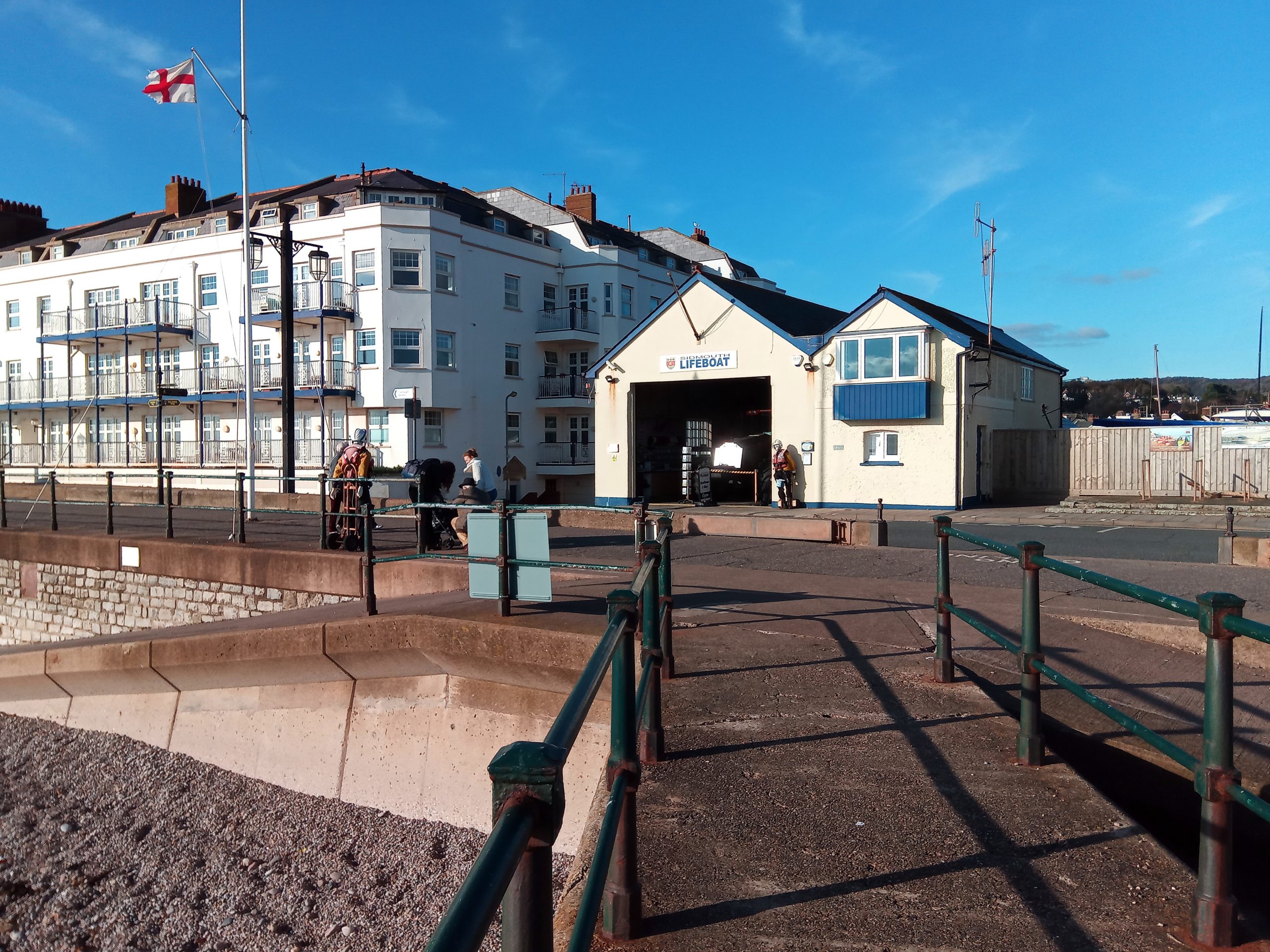
At Port Royal this could be part of a slipway allowing the Lifeboat, and other boats, to enter the water and also be a place where sea transport could load and offload. The draft South West Marine Plan includes mention of Government aspirations to send items by sea not land wherever possible. If people and goods entered Sidmouth from the sea it could cut down traffic in town and help with Sidmouth’s aspiration to become greener.
The current groyne at Port Royal contains an angle with the concrete pier meeting the top of the ramps at a place which could be widened. If this was widened and the building of the slipway allowed for the manoeuvring of the Lifeboat tractor and reaching deeper water it might look something like the following image.
If boats like those used by the Stuart Line Cruises can take onboard passengers from the beach I would imagine they could do so from a slipway.
The original image is from Google Earth
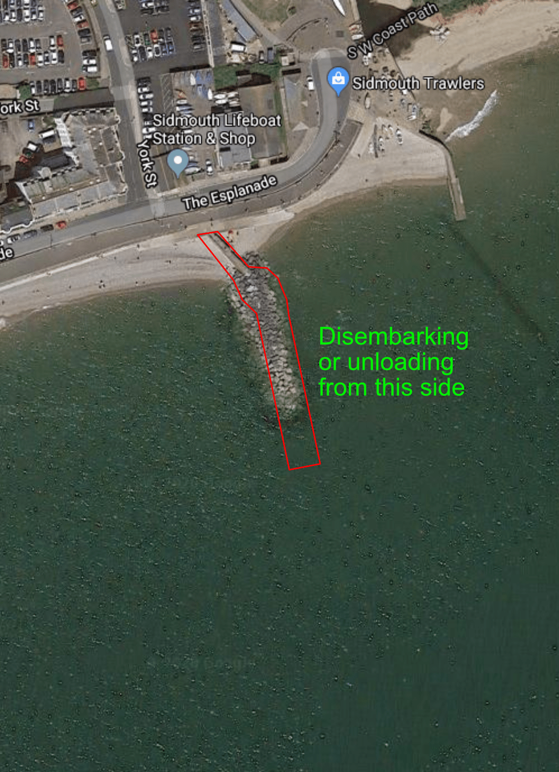
If the eastern side of the slipway goes straight to the sea bed then boats can pull alongside, depending on the tide. The wider bit which would allow the tractor to manoeuvre would also give space for passengers to wait of cargo to be offloaded.
There may be funding available from Tourism or Transport Departments. It might also be that RockFish would contribute as it will bring the restaurant to great prominence.
The image below from Danny Whittle, shown on the Herald website, shows how much further than now the slipway would have to project. I believe this was a very low tide.

The top of the ramps would not have to be widened as there is already a large flat space between the two slopes.
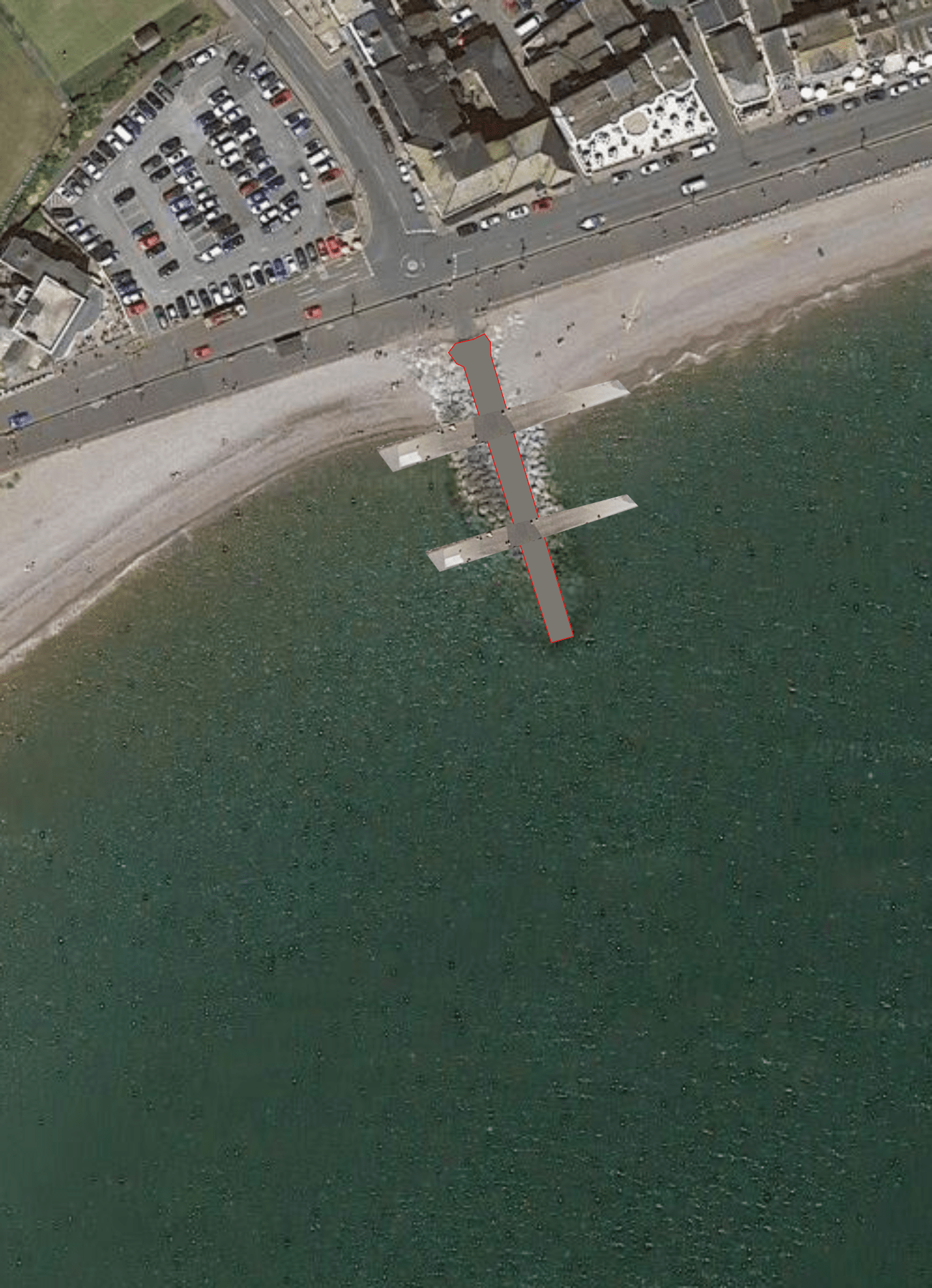
Moving on to the groyne at Fore Street, I think there would only need to be an additional two ramps.

These ramps would help retain the beach in the way that the hammerheads would have on the Options 2 & 3 on the original plans. These and the end of the slipway created would allow access to the beach or sea depending on the tide. Again this would not require any work at the top of the existing ramps. This access to the beach is not as well used as the one at Bedford Steps.
At Bedford Steps we would need a more comprehensive set of ramps, because this groyne would be where the lifeguard needed to be were we to get our Blue Flag Award. A pair of lifeguards here would be able to monitor both the Town and Clifton beaches.
The lifeguard would not only need a good view but quick and easy access to both beach and water at all times of the tide.
We would not need to change the current steps although this might be a good opportunity to do so and solve the problem of the overflow from the culvert which makes the bottom of the steps a nasty entrance to the beach.
If the first, top, part of the groyne was made into a wide platform then the lifeguards could be posted here, perhaps on tall chairs. They could then enter the sea from the bottom of the slipway or from either side. Or the groyne could end in a sharp drop off to enable diving for lifeguards or visitors.
These ramps would also be an easy access allowing people to avoid shingle ridges and provide a safety feature for people who were struggling to exit the water.
Again this is superimposed on a Google Earth image.
It might need some of the rock armouring to be rearranged to give protection to the ramps but at low tide the ramps would provide shelter from winds and play areas for children. If the rocks were arranged with that in mind they could also be a safe area to climb and play.
It is possible that a lot of the rock armour on each of the current groynes could be moved and reused. For example if the bits between ramps were removed it would give the opportunity to provide shelter at low tides by making a wave deflector overhang between ramps on the same side. This might also help with slowing down the force of the waves in storms?
Un-needed rocks, or extra rocks from what would have been the been the new islands, could be placed on the beach to slow down the waves and reduce their force as has been done at other places around the country. This would created sitting and climbing places on the beach and help to retain shingle.
This sort of rock placement on the beach has been done at several resorts including Minehead and Hornsea.
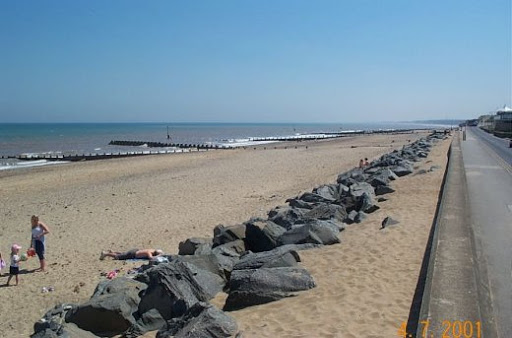
Photo from Geography- learn on the internet
This page also has a video of how the waves are slowed but not stopped by this sort of feature.
Rocks positioned parallel to the shore they are intended to protect can be seen in the following links.
Photomonitor- lost villages
Happisburgh Norfolk
Bawdsey Ferry Suffolk
Another from Bawdsey Ferry
Some blocks were placed during WWII as beach defences against invasion, could this sort of block arrangement (perhaps in two staggered rows) help retain the shingle and give people places to sunbathe?
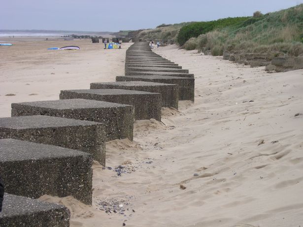
Image from Hull Daily Mail
At approx 1 minute and 50 seconds into the following video it can be seen that there is a second, parallel, row of blocks which have been almost buried. This would suggest that even so far apart they are preventing erosion. At approx 5 mins 40 seconds you can see the erosion which has taken place south of the blocks where the line has been broken and lost.
Fraisthorpe beach by air
I am aware that we are not allowed to put rock armour on east beach, but is that just prohibited if it is against the bottom of the cliff?
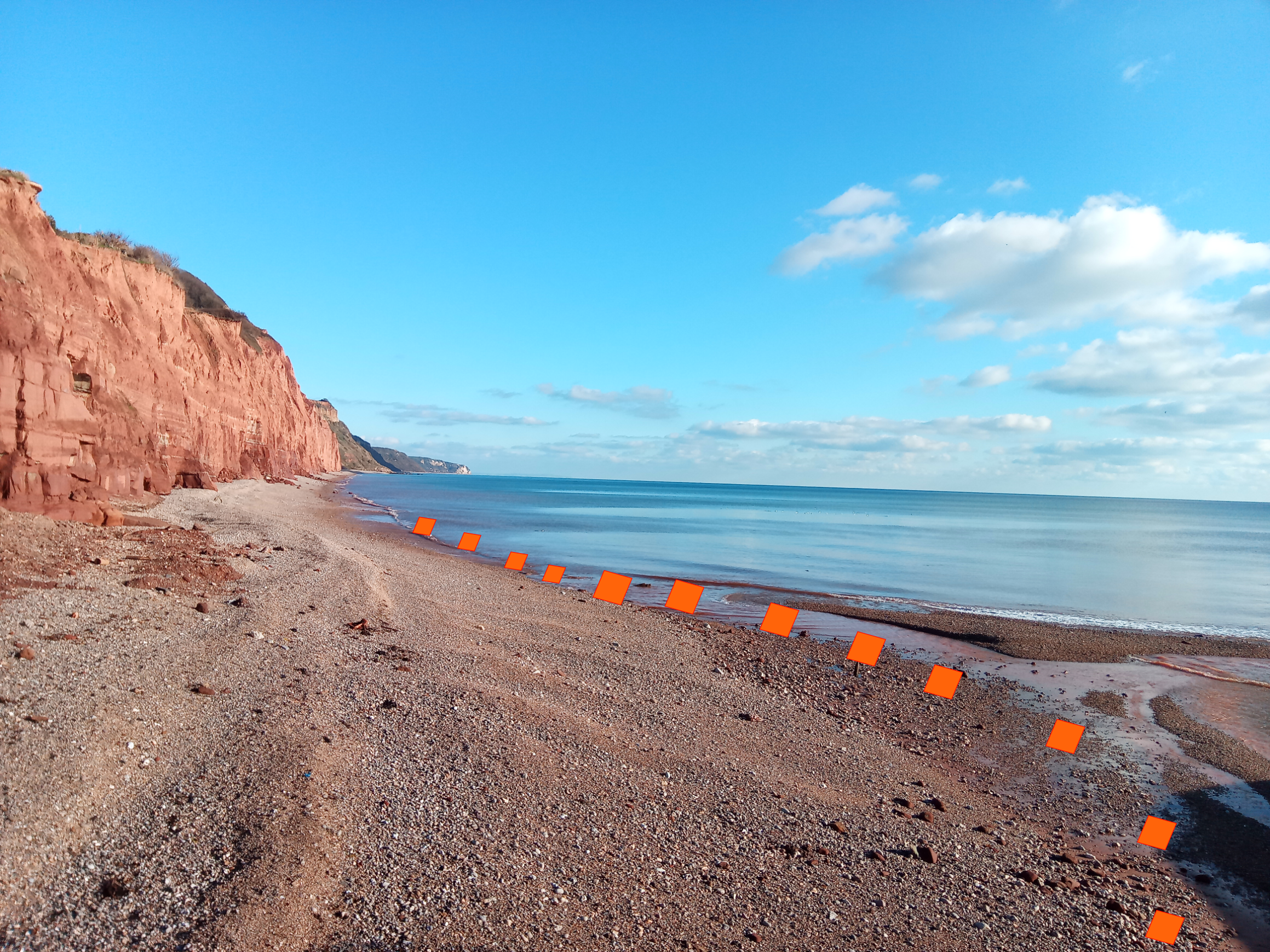
Could it be that we could use rocks further down the beach as seen here?
Geography.org – beach at Mappleton
It is suggested that this allows beaches to build up while having few side effects.
If we could use rocks of some type as shown above they could be used on the beaches in the positions shown on the pictures below.
Either lines of jumbled rock or rock blocks.

With a line of jumbled rocks on East Beach.
Splash wall
I hope that the glass wall currently being tested will be up to the job, as a solid wall will be a big problem for the town.
The only way to mitigate it, in my opinion, is to set it back from the road, thus losing part of the Esplanade. As the Esplanade is very wide this should not be a problem. If it was to be deemed an unacceptable loss I would suggest cantilevering blocks above the current wave deflector edge to raise the height.
It would be possible to raise the whole height of the Esplanade without causing access difficulties but I appreciate it would be costly. If the Esplanade were to be raised then crossing areas like the zebra crossing could be raised above the current road height to form speed bumps. Thus making the road less popular for evening speed trials!
Setting the wall back would allow us to create beds for plants along the roadside. It the current wall was retained but drainage holes drilled through it it could act as one side of the bed with the new taller wall as the inner side. If the glass wall proves suitable I would suggest that the new solid wall be of the same height as the current wall with the glass atop it.
It may be possible to dig through the Esplanade paving at some points to make deeper planting beds which could take something like the Torbay Palms (Cordyline Australis). If the glass is not suitable I think it would be helpful if the road facing, inner face, of the new wall was mirrored to reflect light. This would go some way towards preventing plants growing towards the road.
With a glass wall rather than a solid one the effect would be more like this.

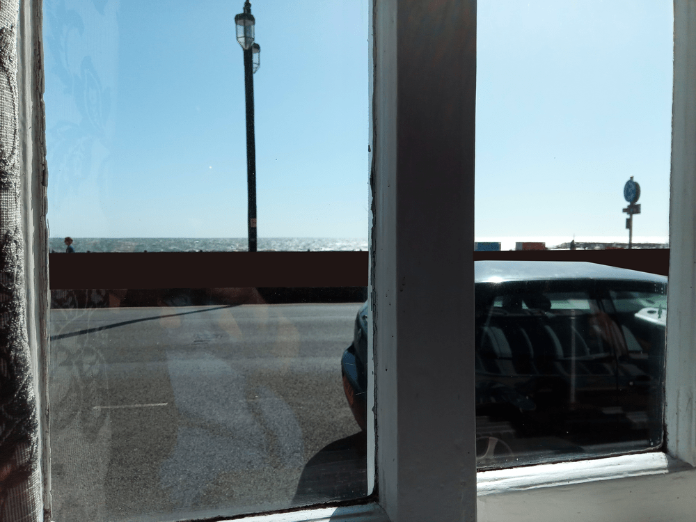
Both of which are much better than this.
One complaint of the businesses along the Esplanade is that they will lose trade with a loss of sea view. The view below is from Pyne’s Bar in the Bedford Hotel.
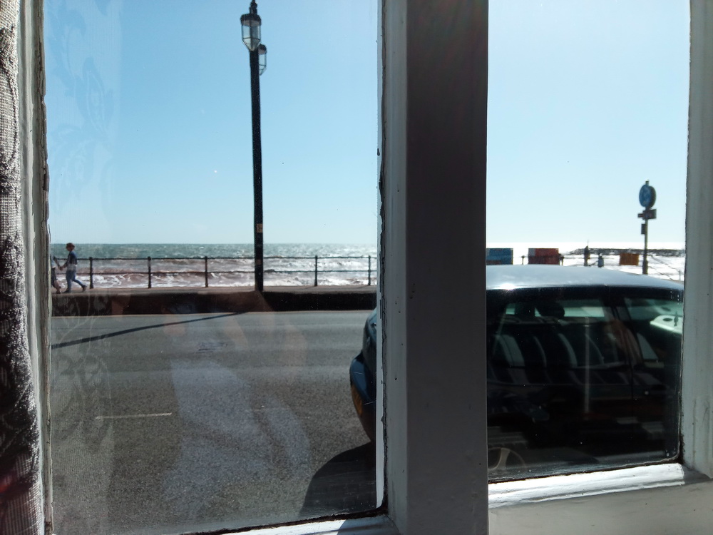
It shows that parking outside can obscure the view of the sea almost as much as a wall would. The wall would appear about as high as the top of the railings from this position, seated at one of the tables.
It looks far less harsh with flowers and trees.
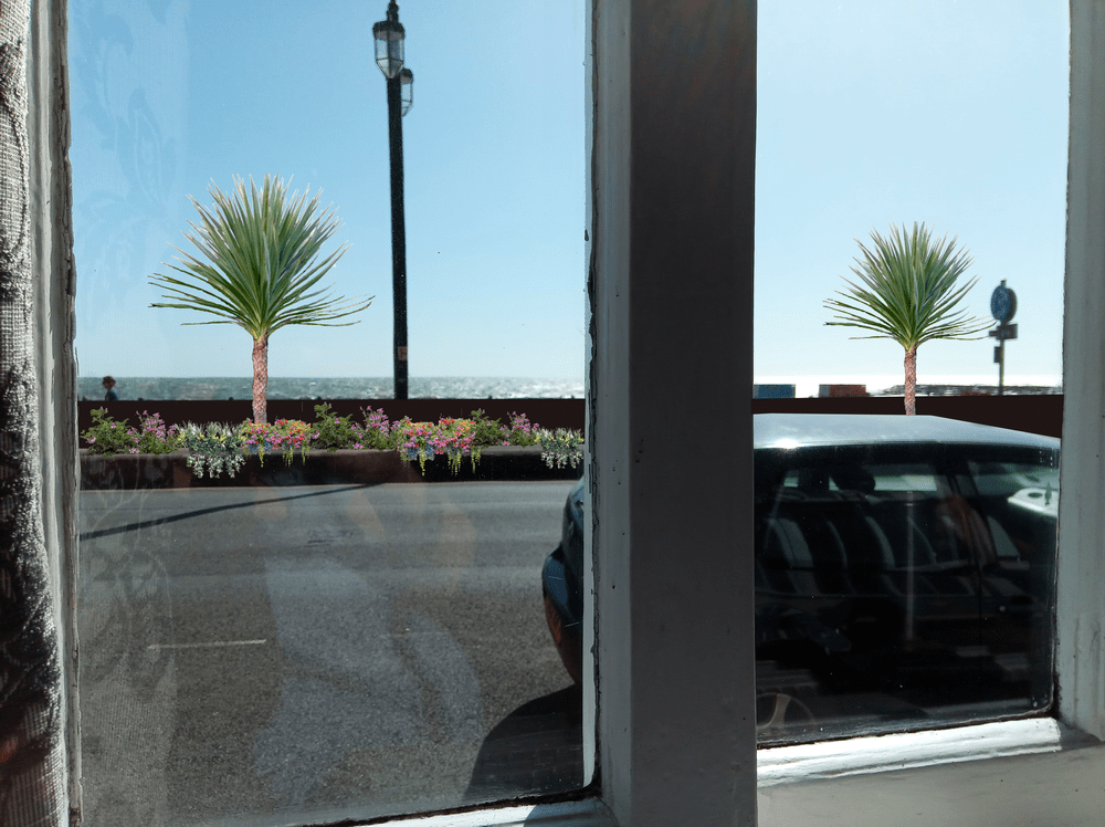
It looks even better with no wall/glass wall.

I think the beds would need to be about 450mm width to get a good display which would mean we lost about 600mm of the Esplanade width to account for the wall width. Unless we use materials which will make the wall thinner than the current one.
I have, of course, considered all these design ideas in much greater depth than I have put here and would be happy to discuss things further if any of the ideas have merit.
When considering the likelihood of these ideas attracting funding that has not already been identified I have taken note of the Draft South West Marine Plan and its aspirations as well as the Government response to the Lords’ paper on Regenerating Seaside Towns and the LGA Coastal SIG.
South West Marine Plan
Sidmouth is in the South Inshore section of the Draft South West Marine Plan, which states.
SW-PS-4 Proposals promoting or facilitating sustainable coastal and/or short sea shipping as an alternative to road, rail or air transport will be supported where appropriate.
SW-ACC-1 makes sure that support will be given to proposals which provide appropriate and inclusive enhanced public access to, and within, the marine area, such as physical, digital, and interpretative access and signage. Support will also be given to proposals which enhance access by removing unsuitable access arrangements.
SW-TR-1 Tourism and recreation are widely recognised as very important sectors within the south west marine plan areas, providing numerous economic and social benefits to coastal communities and visitors to the region.
and
To minimise stakeholder conflict, this policy also addresses the impact of proposals on existing tourism and recreation use, or future potential activities; those that cannot avoid, minimise and mitigate significant adverse impacts on tourism and recreation are unlikely to be supported.
43. In respect of local authority decision-making, development plan policies are a material consideration in the determination of an application for planning permission.
I assume that the sea defences will require planning permission.
Government Response to Regenerating Seaside Towns
8. We recommend that the Department for Transport, informed by the advice of the Ministry of Housing, Communities and Local Government, prioritises improvements to the coastal transport network when it takes decisions on planning and investment. This should be informed by a detailed review of the coastal transport network which includes an assessment of where the greatest socio-economic benefits can be realised through improvements to transport connectivity. (Paragraph 124)
Response: We welcome proposals from Local Enterprise Partnerships, Sub-national Transport Bodies and local authorities and others on transport investment.
and
In addition, the Department for Transport has developed the Rebalancing Toolkit 1. This is designed to help authors of strategic cases assess how a programme or project fits with the objective of spreading growth across the country.
26. We recommend that development and planning processes for future coastal protection schemes should include an appraisal of how designs might benefit the wider economy and the public realm. (Paragraph 262)
Response: At the same time, other principles within the National Planning Policy Framework and associated design guidance should be taken in to account to ensure that development and planning processes not only offer protection, but also take the opportunity to improve public realm and the wider economy.
28. We recommend that action is taken to facilitate greater collaboration between Local Enterprise Partnershipsthat cover coastal areas through the creation of a formalised network of coastal Local Enterprise Partnerships. (Paragraph 294)
Response: The Government agrees that there are benefits to Local Enterprise Partnerships working together on matters of common interest, and many are putting in place collaboration agreements already.
Local Government Association Coastal Special Interest Group
The Position Statements stress the need for joined-up thinking across areas such as beach management, sea defences and tourism.
Local Enterprise Partnerships Heart of the South West and Great South West
These LEPs are working towards making the South West more prosperous in many ways including tourism. They aim to show the country the way in a green economy and therefore will probably support increased transport by sea. This may be somewhere we could get backing for a landing area at Port Royal, or for incorporating clean energy production somewhere along our shore. Perhaps on the existing rock islands or at the ends of new groynes.
When looking at erosion defences I have found the following documents interesting.
A) Coastal zone management and special coastal protection works in vulnerable lagoon ecosystems: The case of ” Venice lagoon ” (Italy) and ” North Amvrakikos gulf lagoons complex ” (Greece)
LINK
B) Retaining walls – A case study of the Worli Seaface
LINK
C) Wave energy converters in coastal structures
LINK
D) Eurosion
LINK 1
LINK 2
LINK 3
Mary Walden-Till 5th Feb 2020