The BMP currently (1st Feb 2021) includes a modelling prediction that Sidmouth will suffer flooding from the sea every year. This prediction was made in 2017 and has not been proven correct so far.
After the storm damage in places along the coast on the 31st Jan 2021 it has been thought prudent to start collecting information about how Sidmouth has faired in these events. The images below are part of this process. Click on them to make them bigger, or make the videos full screen from the icon in the bottom right of them.
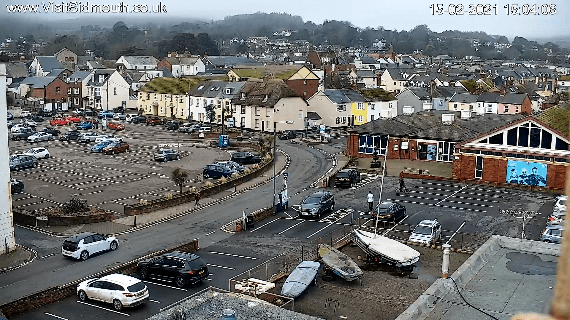
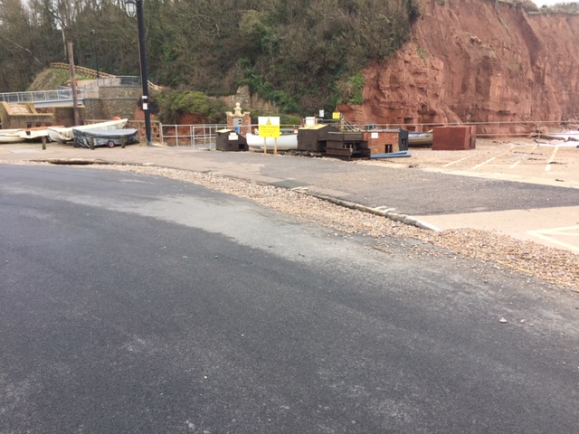
15th February 2021
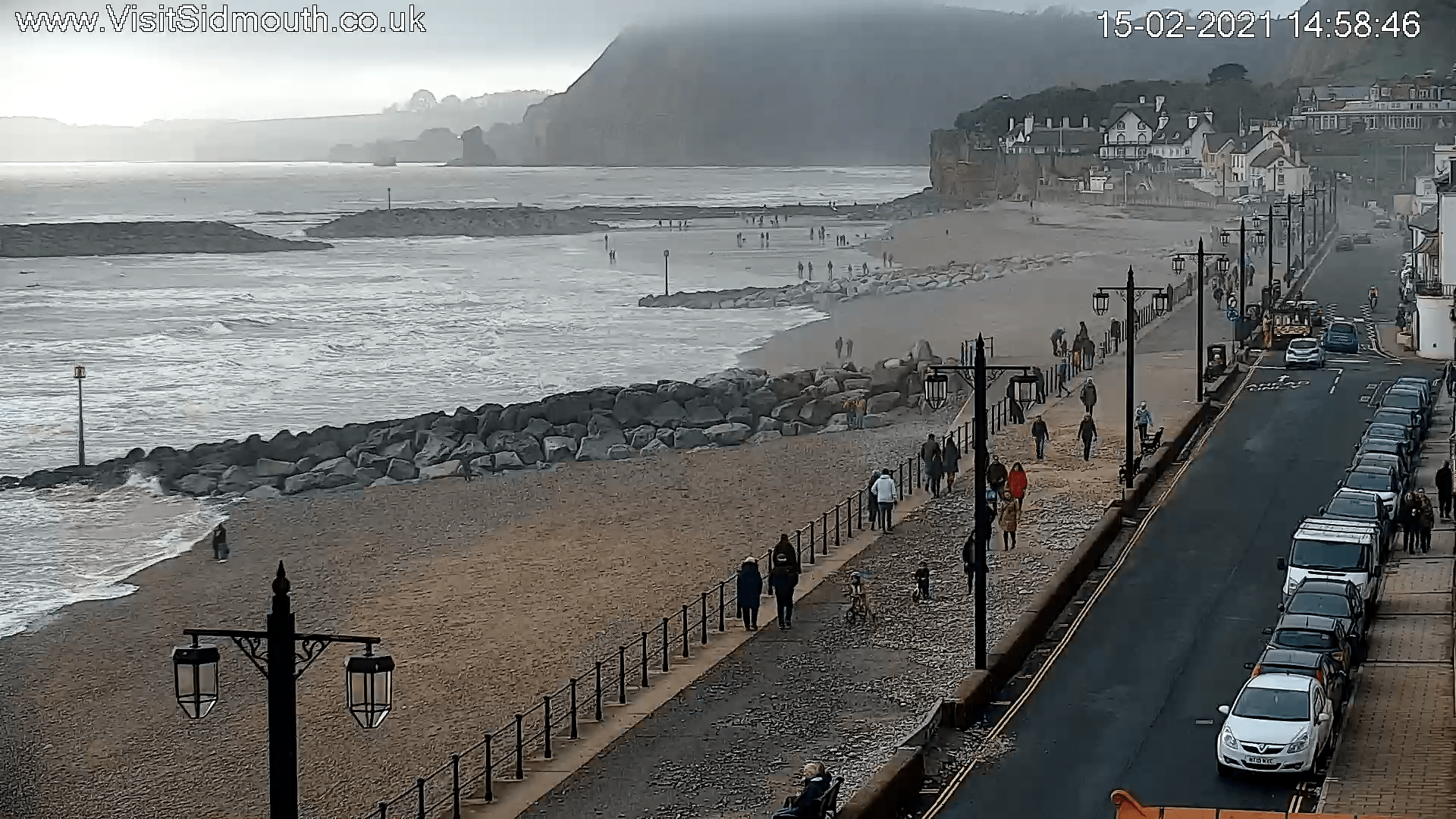
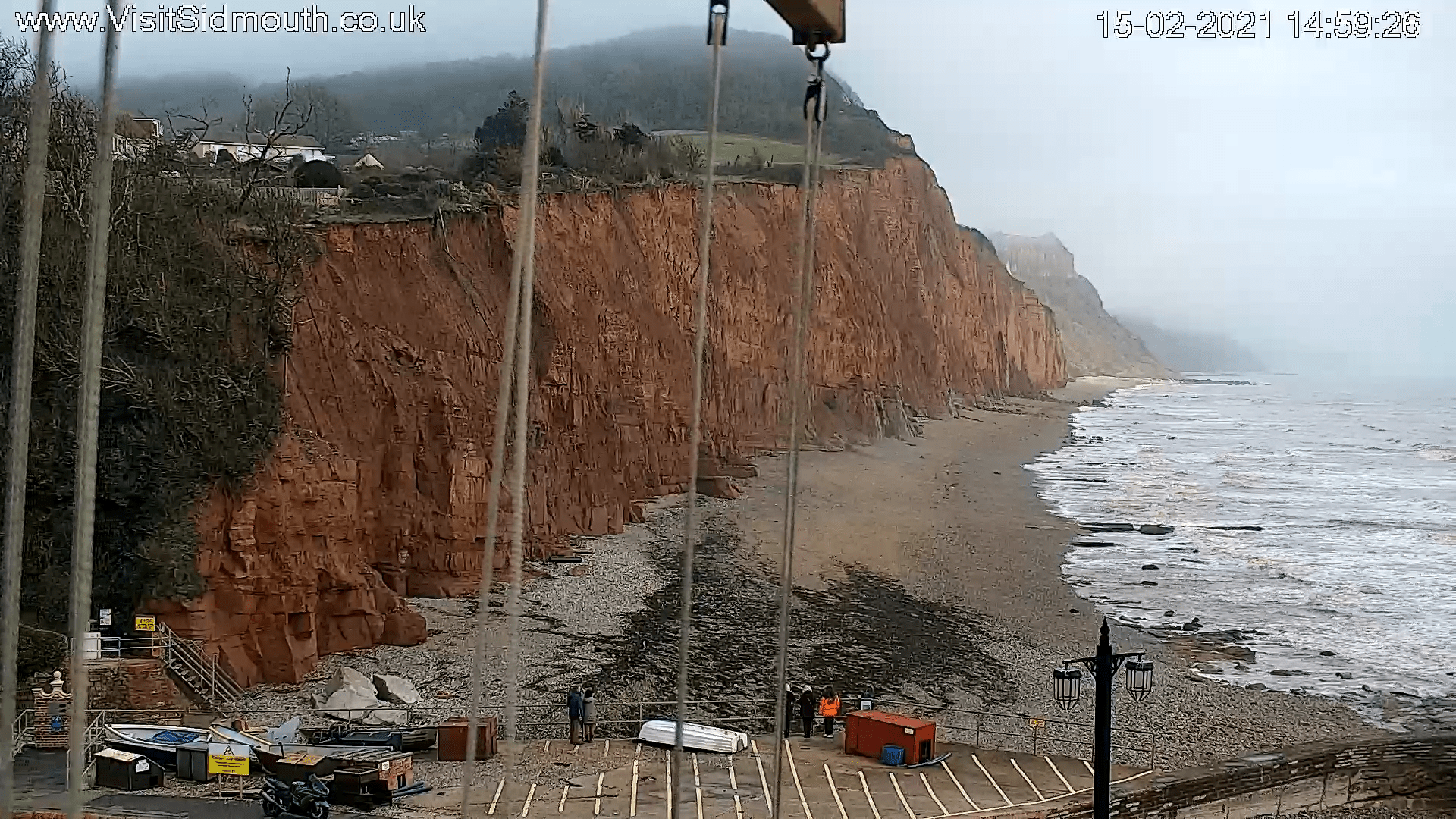
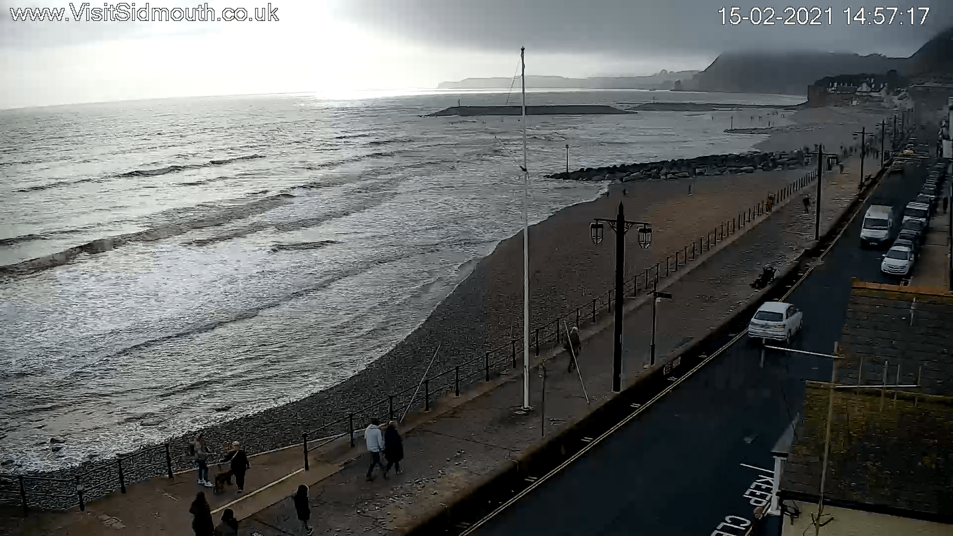
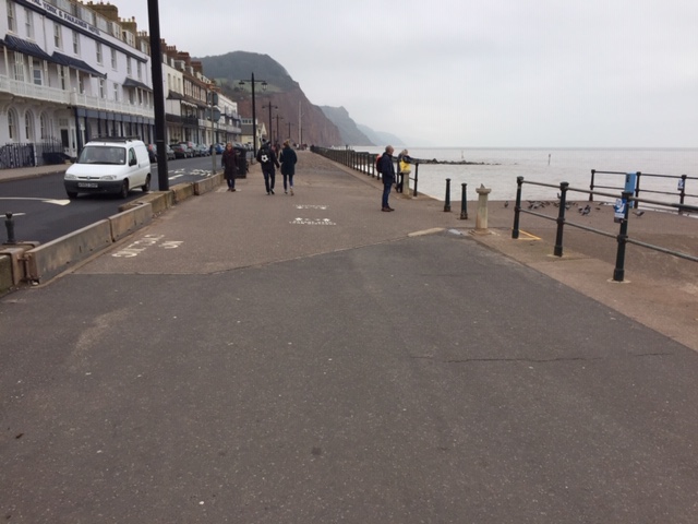
These images show the debris left behind after the storm. There is no sign that water reached the car parks.
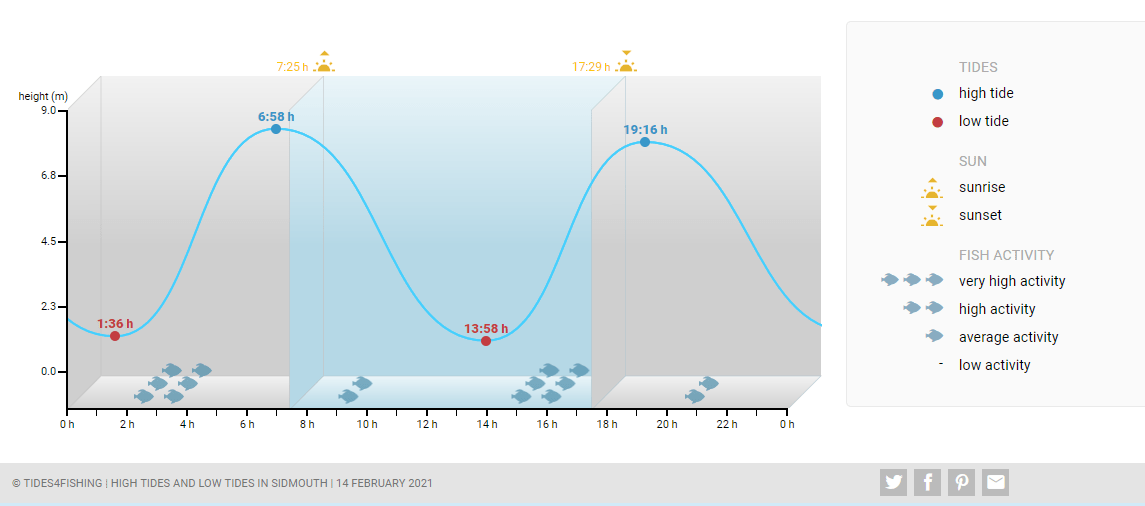
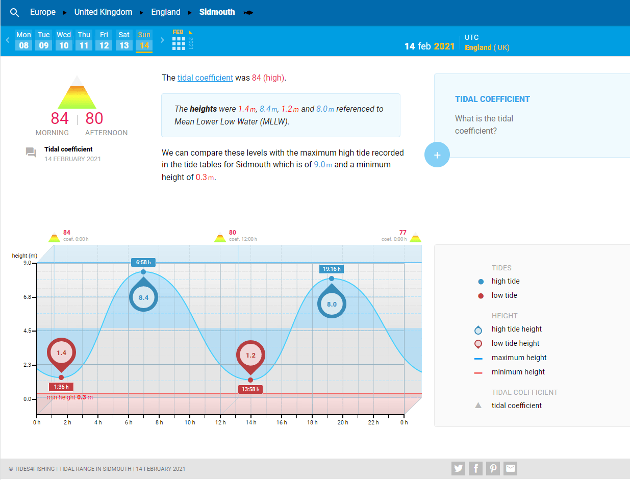
14th February 2021
It has been a stormy few days with the winds running straight on to Sidmouth beach. The evening high tide was at 7.16 pm (19.16 hrs) according to Tides4fishing which give lots of useful data. They also said that the tide was high.
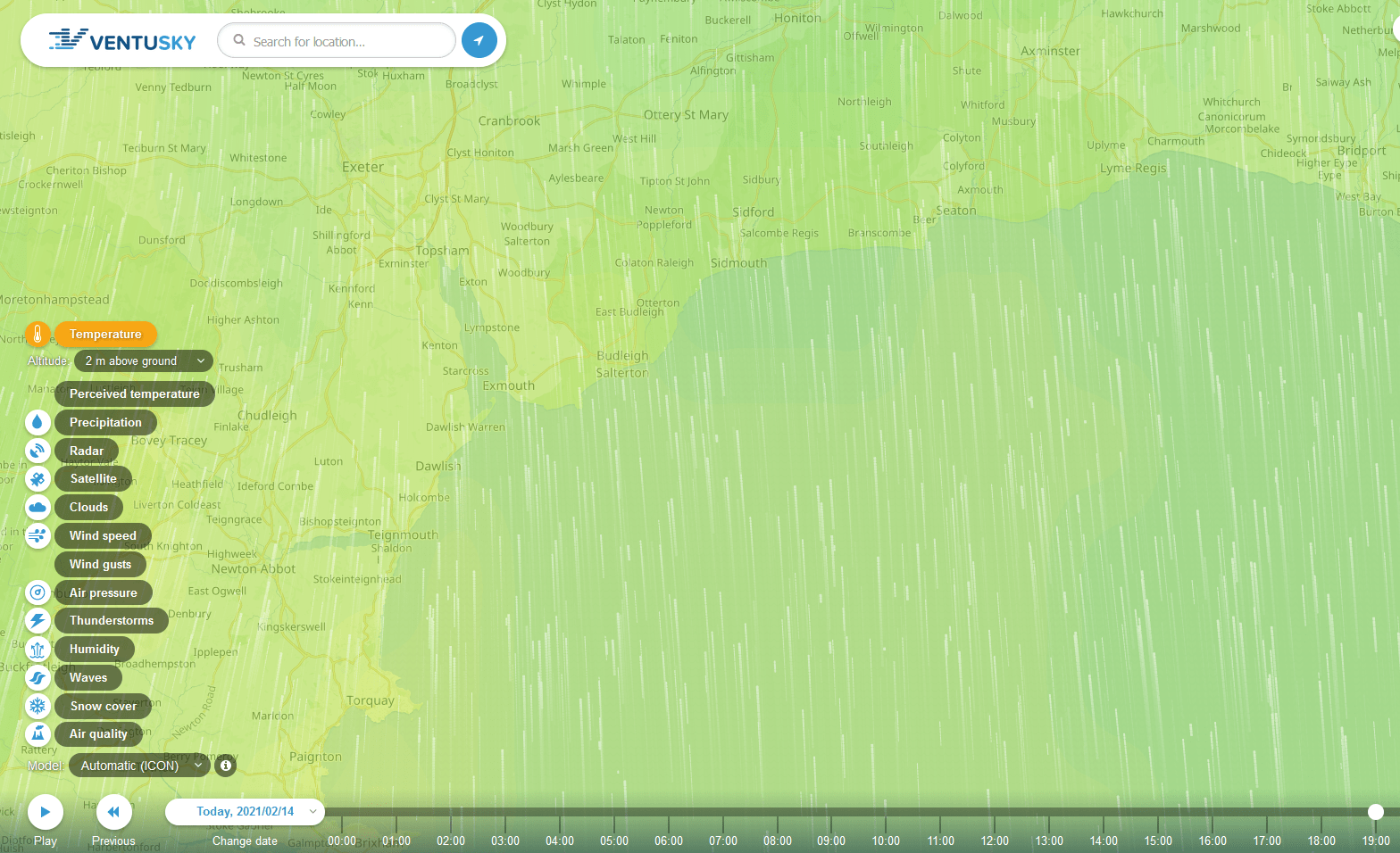
The images below are from Ventusky.com where you can see both weather forecasts and information about past weather.
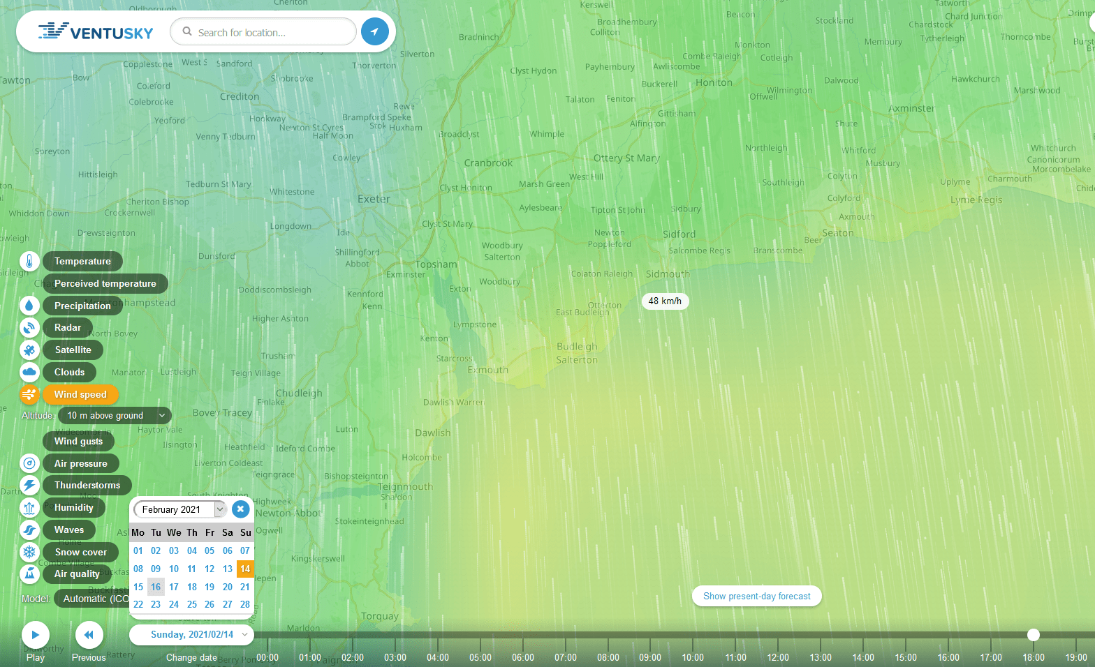
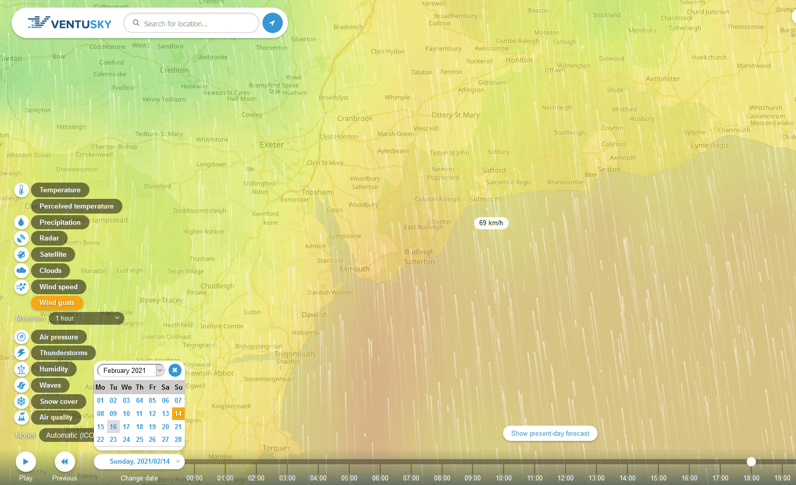
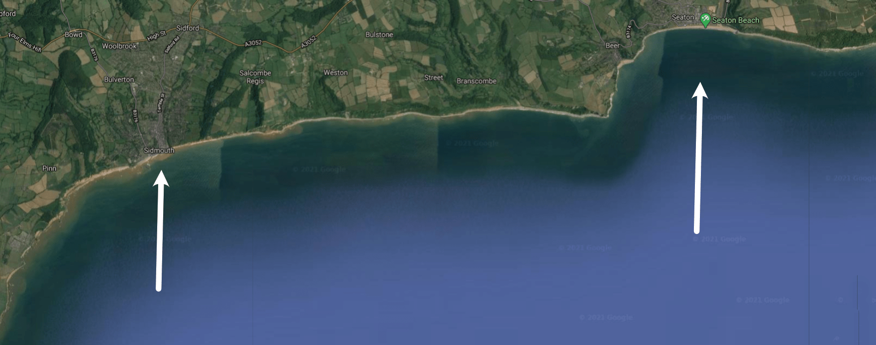
The wind strength and direction, and tide height means that we saw conditions which are nearing the top end of the ‘damage’ we might expect to see in a storm event.
Because of this we took footage from the Port Royal webcam on the Visit Sidmouth website which can be seen below. This footage shows some very important things.
1) The water and shingle is being thrown up where the beach is very low, at the end of Fore Street the beach is high and the wave energy dissipates before it hits the sea wall.
2) Where the water does hit the sea wall the current modest recurve on the wall works to throw the water into the air. The water which lands on the Esplanade footway and road is from spray.
3) The camber on the Esplanade footway is not sufficient to return the water to the sea quickly or at all. Opposite York Terrace the sea water returns to the sea slowly but in front of the Drill Hall the water drains towards the dwarf wall instead of returning to the sea.
4) The dwarf wall is more than high enough to stop any water on the footway reaching the road.
5) Spray water which reaches the road is not being cleared by the drains. It remains as a puddle or slowly drains towards the launching slipway.
6) The angle of the launching slipway combined with the angle of the training wall creates a lot of turbulence which hinders the flow of water up onto the turning circle. It can be seen that a straight ramp as proposed in the current plans would cause the water to run up far more strongly.
7) Looking at East Beach it can be seen that the waves are not strongly crashing against the cliffs. A higher beach, or slowed waves, would give a large degree of protection against erosion from the sea. It should also give insight as to the reasons for erosion at that point.
8) It can be seen that the current flood gates on the Esplanade may not work as well as we would like.
I did not record footage from the west as the high beaches there were preventing water getting on to the Esplanade, from what could be seen on camera.
Some of the footage from high Tide can be seen here. The first video shows in front of York Terrace and later some from East Beach. The second is from In front of the Drill Hall.
.
We have been very fortunate in the fact that Nadine Vellender has shared some video she took from ground level at approximately the same time and from the same place as the webcam above. You can use the flag pole as a reference point to match up the overhead webcam footage with the ground level footage from Nadine. The copyright of the footage below belongs to her so please do not reuse it without her written permission.
The video has been slowed to half speed to allow us to see more easily the way the water is moving as it hits the sea wall. The first section of video was taken at 19:44 the second 19:45 and the third was 19:46.
.
31st January 2021.
From Cllr Chris Lockyear STC
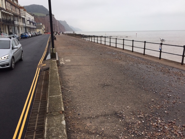
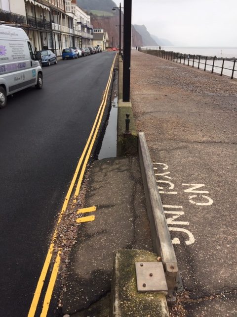
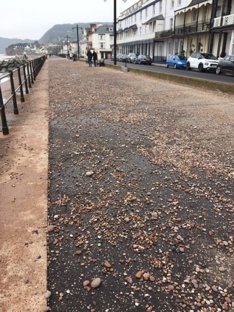
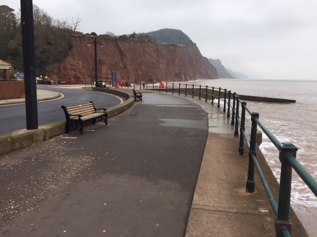
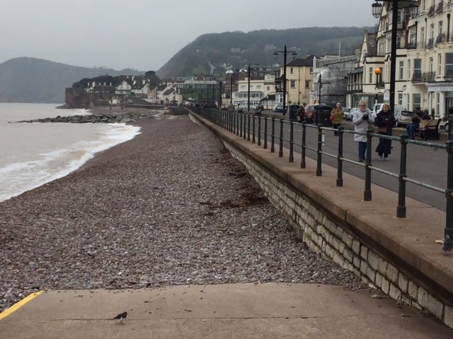
The images above show where the pebbles have been left and this indicates where large amounts of water reached. They show that the current dwarf wall did a very good job of containing most seawater overtopping to the Esplanade. Very little made it over on to the road. The place where the shingle was thrown on to the Esplanade was where the beach is very low.
There was no sign that the lowest lying areas of the town had suffered any flooding yet Seaton suffered major damage. Reports are that the waves at Seaton were coming straight on to the sea defences, so at a slight angle at Sidmouth if the wave direction was constant.