All these images have been pinched from Youtube and we do not hold the copyright!
I have put them here as a reminder of things we might need to look up again when creating documents. I have also added useful links at the bottom of the page.
.
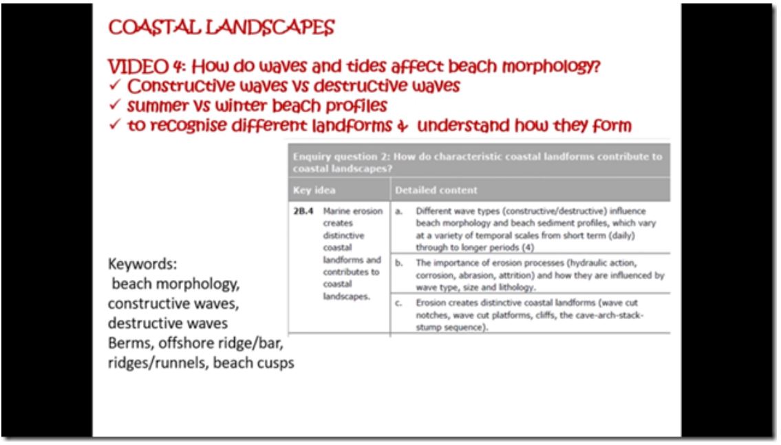
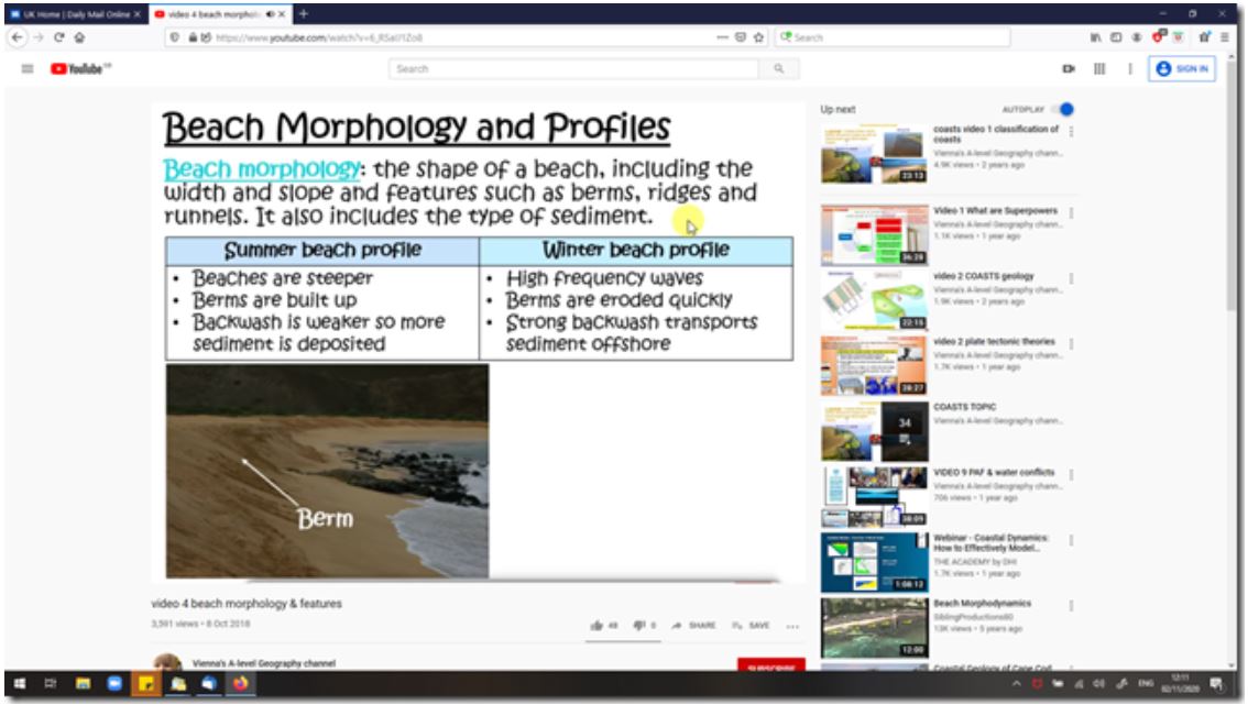
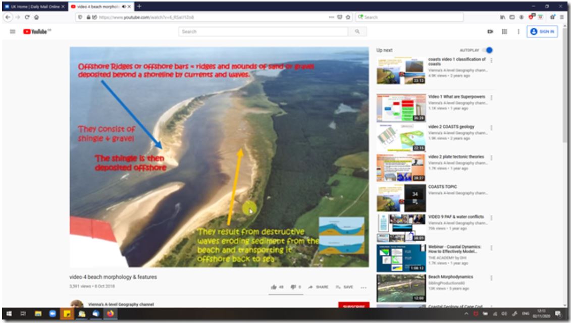
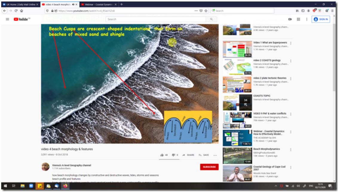
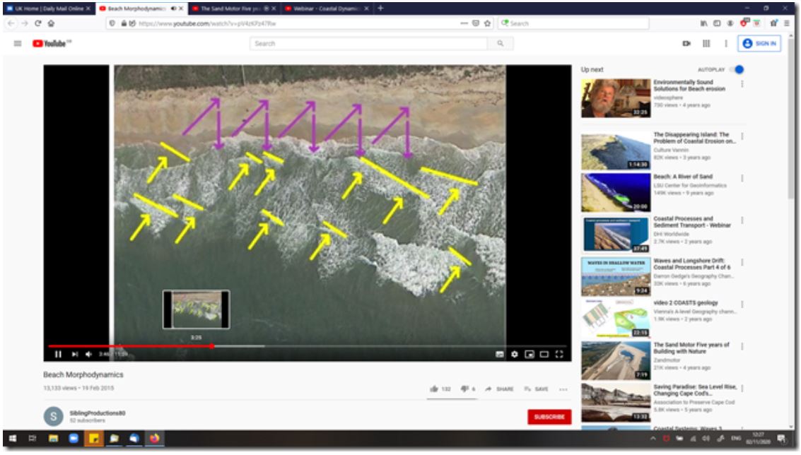
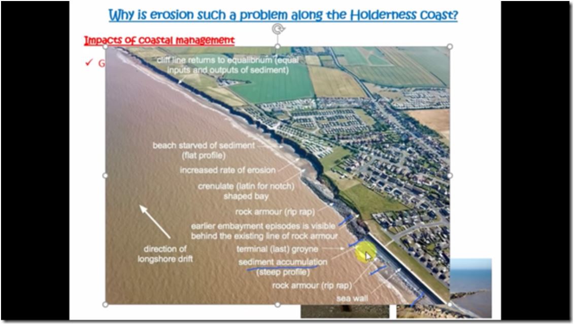
Beach cusps (above) form only in low energy bays.
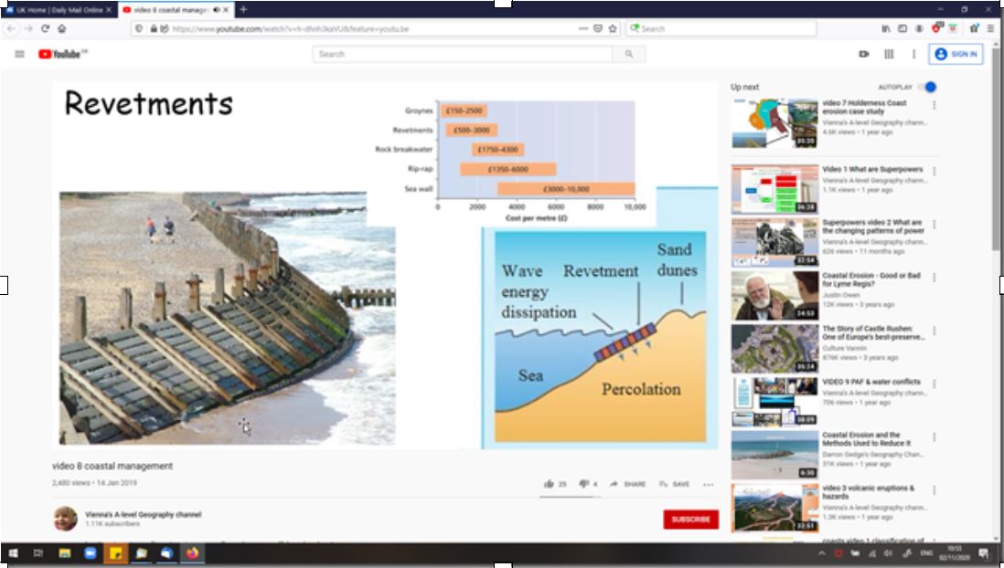
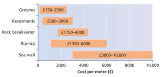
The costs given here are probably out of date as the video is from 2019, but the chart reads
Papers :-
a) http://citeseerx.ist.psu.edu/viewdoc/download?doi=10.1.1.569.8440&rep=rep1&type=pdf
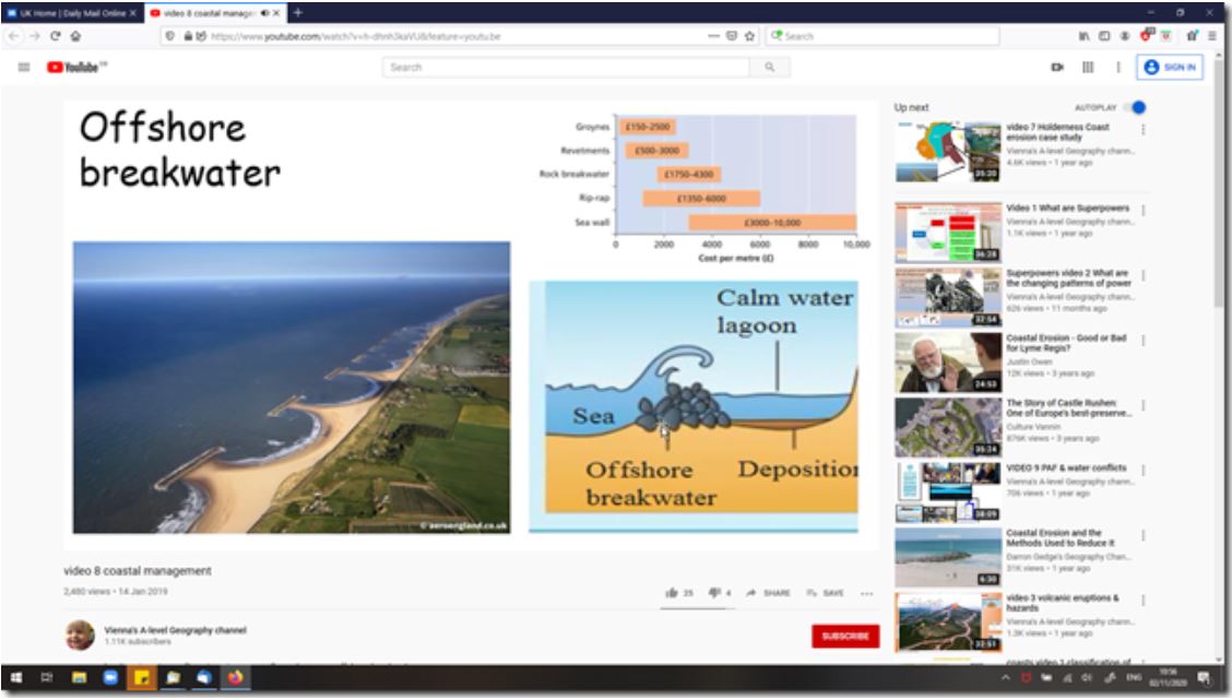
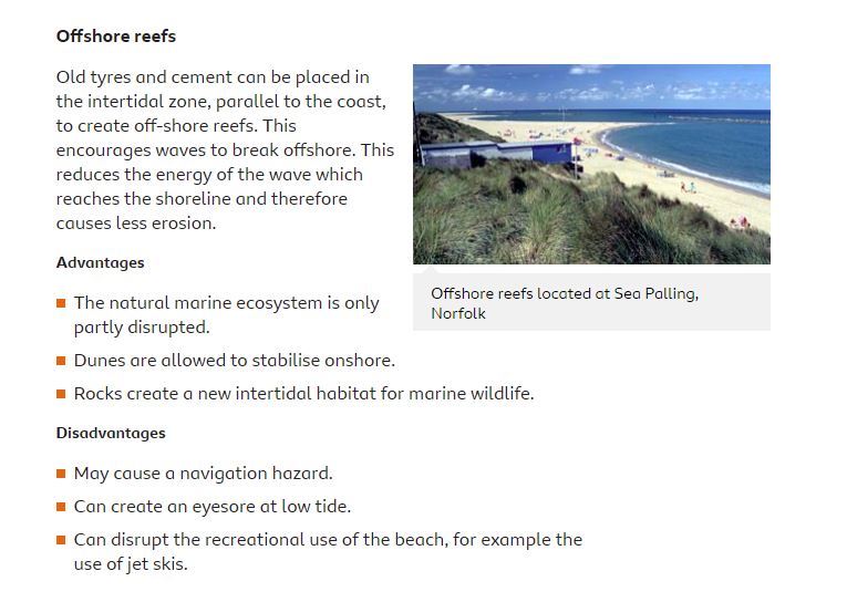
Re-nourishment with construction of groynes or rock walls has been undertaken to overcome the sediment losses, but the costs have been high, and the mitigation has not been sustainable in the long term. The responsible agencies (mostly local councils) have questioned their own willingness to re-nourish and maintain the structures due to the accumulating costs. This paper describes offshore underwater reefs that act to dissipate or rotate the waves. On a “dissipator”, the reef acts to reduce the reduce wave energy at the shoreline by wave breaking. The “rotator” reduces the longshore currents to stabilise the coast. The reefs also have the important benefit of creating opportunity for incorporation of surfing and other water sports as artificial surfing reefs (ASR’s).
b) https://bioone.org/journals/journal-of-coastal-research/volume-36/issue-4/JCOASTRES-D-19-00117.1/Salient-Evolution-and-Coastal-Protection-Effectiveness-of-Two-Large-Artificial/10.2112/JCOASTRES-D-19-00117.1.short
Two offshore reefs constructed at Ullal, Karnataka, on India’s west coast, are exhibiting coastal protection benefits. The reefs are large (275 m and 325 m long) and uniquely placed well offshore (600 m and 760 m) in intermediate depths (6 and 7 m below chart datum). Their crests are between low-tide and midtide level. Bathymetric and beach surveys show that sand has accumulated to form two evolving shoreline salients, which are currently 2–3 times the length of the reefs. The salients have grown underwater on the inner shelf to create a large sand-retention zone up to 1 m thick and stretching from the beach to the distant lee of the reefs. The reefs are the first protection structures that have restored the beaches and enhanced sand storage over this broad, severely eroded region, both inshore and on the inner shelf. Prior rubble-mound rock revetments (seawalls) and 50–70-m-long groynes failed to restore the beach in stormy monsoon conditions, while the inner shelf continued to erode. The reefs were designed using a combination of computer simulations, measurements of natural salients in India, and empirical relationships. The methodology that led to the reef shapes/sizes and their position offshore is discussed, along with monitoring results.
Reference sites and docs
a) https://climate-adapt.eea.europa.eu/metadata/adaptation-options/groynes-breakwaters-and-artificial-reefs
in 2000 construction costs for rock groynes ranged between GBP 10,000 and 100,000£ (12,500 – 125,000€) per structure. Construction costs of breakwaters are high – GBP 40,000 to 100000 (50,000-125,000€) – but they require low maintenance; for these two structures in particular, beach nourishment costs should be added. Artificial reefs construction costs are relatively high – GBP 20,000 to 60,000 (25,000 – 75,000€)/100m of structure.
Videos